International cooperation
Latin American countries seek resources for natural disaster management


November 18, 2019 04h00 PM | Last Updated: November 21, 2019 01h37 PM
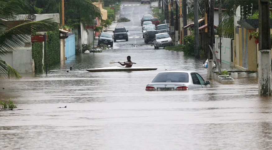
Brazil and 13 other Latin American countries that have already adopted the Geocentric Reference System for the Americas (SIRGAS) are prepared to conform to the Global Geodetic Reference Frame, which is recommended by the United Nations (UN) for adoption. The frame aims at measuring the Earth, based on its orientation in space, its gravitational field and its shape. This is crucial information for managing climate changes and natural disasters.
But, in order to be in line with UN's proposal, the international geoscience and geodesy community will need to raise funds with governments and multilateral bodies. “The UN resolution has opened the possibility to warn governments that geodesy is a State and strategic issue for governing a country. Governments should provide economic support so that an agency such as the IBGE, when it has to open a station, has the necessary resources available,” said Munich University of Technology researcher Ms. Laura Sanchez, the former SIRGAS vice president.
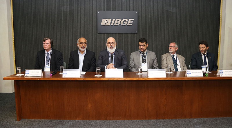
The issue was discussed in the 2019 SIRGAS Symposium which gathered the main international bodies in the field of Geodesy and had the participation of experts from 14 Latin-American countries, as well as representatives from Germany, the United States, Austria and Italy. The event was held by the IBGE and the State University of Rio de Janeiro (UERJ), from November 11 to 14, at the IBGE Center for Information Documentation and Dissemination (CDDI).
The head of the Department of Cartographic Engineering of Uerj, Mr. Luiz Paulo Souto Fortes, points out that the symposium has been held since 1993, when the International Association of Geodesy (IAG) created SIRGAS.
“The SIRGAS initiative has deployed in Latin America a common geodetic reference infrastructure that is considered as important as the infrastructure for electricity, sanitation and telecommunications , providing positioning reference for any point, anywhere in the region, for applications such as in construction works and infrastructure,” explains Mr. Fortes.
Colombian National Mining Agency expert and current SIRGAS President Mr. William Martinez says Colombia has adopted SIRGAS in 2005 and has experienced a breakthrough in granulometry, permanent stations and data processing as well as in the strengthening of different academic and research sectors and companies that were created.
“To date 14 countries in the region have adopted SIRGAS at the national level. Adoption depends on each country's internal situation, many lack resources. Now, as a UN theme, geospatial information management will surely strengthen technical centers like the IBGE,” believes Mr. Martinez.
IBGE Geosciences Director, Mr. João Bosco de Azevedo, claims that SIRGAS give support to systems of satellite localization as GPS, American, and Glonass, Russian. He highlights that, besides hosting the event for the first time, the IBGE has gained even more relevance before the international geoscience community with the election of Ms. Sonia Costa, IBGE Geodesy Manager, as president of SIRGAS for the next four years. “Brazil has adopted SIRGAS in 2005 and is now ready to adopt the global system recommended by the UN”, reinforces Mr. Azevedo.
Ms. Sonia Costa says that the choice of a Brazilian representative shows the importance of the country in the continent as well as its relevance in the production of geoinformation, not only in the field of geodesy, but also in cartography and in the infrastructure of spatial data.
“Geodesy is the reference lay for all georeferenced information. Up to 2005, we used to have an old methodology, there were no satellite systems and the countries' cartography could not be integrated together. Today there are four systems that compose the GNSS (Global Navigation Satellite System): the GPS (American), the Glonass (Russian), the Galileo (European), the Beidou (Chinese). It facilitates the monitoring of natural disasters and allow for the alert sign when there are risks. Japan expects to come up with centimetric precision soon next year”, Ms. Costa highlights.
Vertical reference system
Mr. Hector Rovera, an expert of the Pan-American Institute of Geography and History, linked to the Organization of American States (OAS), points out that many countries adopt their own systems, but with the UN resolution, all countries will adopt the global system to better monitor climate changes and disasters. An effort is being made for the USA and Canada use the system as well so that SIRGAS can actually cover all the Americas.
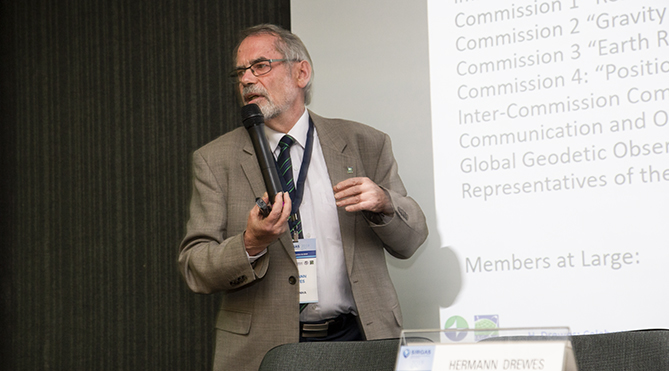
“USA and Canada are behind, using systems based on 1983-technologies and now theu have to change everything for the international reference framework which is 100% consistent with the satellite systems as SIRGAS is, for instance”, syas Mr. Hermann Drewes, IAG's Under-Secretary-General and representative of the entity at SIRGAS.
Mr. Victor Cioce, SIRGAS working group chairman, says this is not a problem per se, but only a matter of organization as the systems used by both countries are compatible with SIRGAS. “The implementation of SIRGAS has advanced a lot. What is missing is a vertical reference system, but there are no uniform local physical systems,” summarizes Mr. Cioce.
Ms. Maria Virginia Mackern, researcher at the National University of Cuyo in Mendoza, Argentina, and vice-president of SIRGAS, highlighted at the event the advance of SIRGAS by establishing a geometric landmark. Now, in addition to intensifying the use of SIRGAS within countries, the goal is to establish an altimetric framework so that SIRGAS also becomes the vertical reference.
Today each country has its own vertical system and unifying the standards is one of the main themes that mobilize the geodetic community. Mr. Drewes from IAG says this is one of entity's challenges, along with analyzing and calculating all the effects of global climate change; developing marine geodesy; and adopting all modern techniques.
“The vertical reference system is a challenge because many countries have measurement systems in places with different sea levels; like Brazil with two points, and Chile with five. We are working to solve the problem scientifically and this needs the support of local governments. The UN has already decided that the global system is a necessity for sustainable development worldwide. Thus, we consider that it is possible to request financial assistance from the UN and the World Bank,” says Mr. Drewes.