ENCE opens course on the integration of statistical and geospatial information


April 11, 2025 02h00 PM | Last Updated: April 15, 2025 01h10 PM

The National School of Statistical Sciences (ENCE/IBGE) will open pre-registration on April 16 for the course “The Integration of Statistical and Geospatial Information and its Benefits for Society”. The course is free and addresses the fundamental principles and practices for the integration of statistical and geospatial information, emphasizing its benefits for evidence-based decision-making.
Interested participants should access the website https://ence.ibge.gov.br/index.php/trilhas/sneg, which provides more information about the course. The link to the pre-registration form will be made available starting at 9 am on April 16 (Wednesday) and will be available for 24 hours, until 9 am on the 17th.
The community of users, informants and producers of statistical and geospatial information will be offered 10 places, distributed by Major Region and sex (one place for men and one for women in each Major Region). The tiebreaker criterion is the order of pre-registration. Complete or ongoing higher education is required.
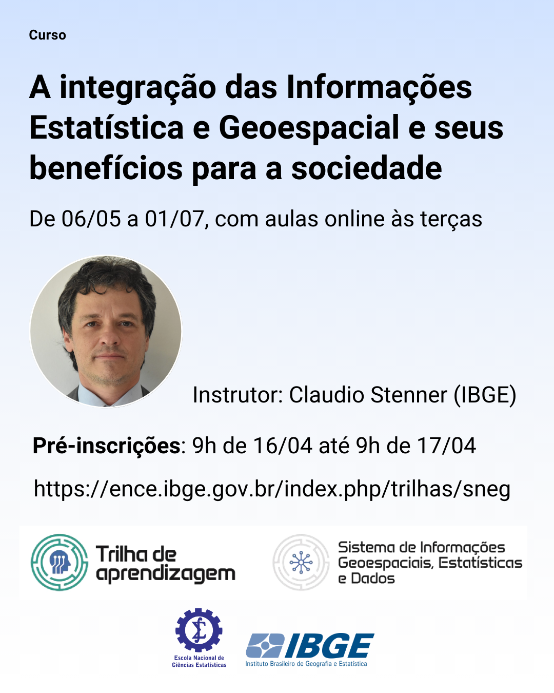
The course will be carried out from May 6 to July 1, 2025, in a total of 26 hours, with online meetings on Tuesdays, from 2 to 4 pm. There are 18 hours of synchronous activities (classes, seminars, and debates) and 8 hours of asynchronous tasks (reading and research). Attendance of 75%, submission of an essay, and participation in the final project will be required.
The instructor is geographer Claudio Stenner, IBGE servant since 2002. He was the IBGE Geography Coordinator from 2013 to 2020 and IBGE Director of Geosciences from 2020 to 2024. He is currently co-chair of the United Nations Expert Group on the Integration of Statistical and Geospatial Information (UN EG-ISGI).
The main topics covered include:
* International Statistical System and Geospatial Information: perspectives, main actors, role of the UN and the Global Statistical Geospatial Framework (GSGF).
* National Statistical System and Geospatial Information: information governance, statistical and geospatial integration at IBGE and relevant actors and their actions on the national scene.
* Case Studies: Discussion of practical cases, with benefits and challenges related to the production, communication and use of integrated statistical and geospatial information.
The integration of statistics and geospatial information deepens the understanding of reality, as it considers that social dynamics are updated and integrated in the territory. This is where contradictions manifest themselves and disputes and their solutions materialize. This integrated perspective brings benefits for a better understanding of society and for access to more relevant information for users.
Agendas such as the UN Sustainable Development Goals (SDGs) require this integrated approach for a more effective implementation, following the purpose of leaving no one out. In the statistical production stage, this integration brings gains in efficiency and accuracy through improved planning and supervision, standardization of geographic sections and codes, and interoperability between the two domains, geographic and statistical. In statistical dissemination, access is democratized and more inclusive, since it gives visibility to local phenomena, i. e., those closer to the user.
Learning paths
The course “The Integration of Statistical and Geospatial Information and its Benefits for Society” is part of the National System of Statistics and Geography (SNEG) learning path, a project by ENCE/IBGE. It aims at providing educational resources that cover basic concepts and instrumental skills related to the purpose, structure and dynamics of the System. Other courses and paths are being developed and will be launched soon.