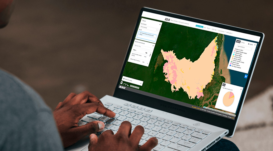
Posicionamento por Ponto Preciso
IBGE updates free web application manual for GPS users
September 16, 2020 10h00 AM | Last Updated: September 23, 2020 02h14 AM
Highlights
- New manual presents statistics on the use of the Precise Point Positioning (IBGE-PPP) online service.
- The web application has processed more than two million items since its release, in 2009.
- The app provides users of satellite navigation equipment, such as GPS, with high-precision coordinates.
- Results with milimetric precision are submitted in few minutes and according to the official system (SIRGAS2000).
- Brazil is the only country in Latin America with an online and free data processing service of this kind.
The IBGE launches today (16) a new edition of the manual for the online Precise Point Positioning Service (PPP), a free web application that provides latitude logitude and height coordinates coordinates from any position on the planet. The web app generated by equipment that collect signals from satellite navigation systems, such as topographic and geodetic GPS – used by engineers and surveyors. All the coordinates indicated by the app are in accordance with the Geocentric Reference System for the Americas (SIRGAS2000), officially adopted in the country.
The manual now has a chapter on app use statistics. It shows, for example, that the service has processes more than two million files from about 60 thousand users in Brazil and abroad since its release, in 2009. The new edition also presents an overall view of users by type of equipment used in surveys, by processing mode (static or cinematic) and by period of data collection.
According to João Bosco, the IBGE’s Geoscience director, the same way the Institute manages the National Statistic System, it is also responsible for the management of the Brazilian Geodesic System, according to the Decree Law of 1967. “Our current challenge is to follow technological evolutions to meet society’s demand. The continuous update of our resources shows our commitment,” he adds.
“The main advantages of this system are being practical, accurate and free of charge,” states the IBGE’s Geodesy manager, Sonia Maria Alves da Costa, as she mentions Brazil is the only country in all Latin America that offers that kind of georeferencing service free of charge. The available tools on the Institute’s website, according Sonia, are important and necessary for infrastructure works, territorial planning, demarcation of rural establishments, and other activities regarding engineering.
The service also showed its relevance after the collapse of the Brumadinho dam, Minas Gerais, in January of 2019. “We believe that our service was useful for measuring the tragedy and even in the rescue of victims”, Alberto Luís da Silva, IBGE’s GNSS Processing supervisor, comments.

Equipment compatibility and use
At present, there are three categories of GPS equipment in use: recreational (or navigator), topographic and geodetic GPS. For the last two, it is necessary to process the acquired information before making use of them. For free treatment by the IBGE’s system, it is necessary to send only some information, such as GPS or GNSS data (as compressed files, if possible, to reduce the necessary time for the system to receive the information) and the type and height of the antenna used in the survey.
The results are sent a few minutes after the data submission, via the email provided by the users. The software for coordinate processing is available on the website www.ppp.ibge.gov.br.
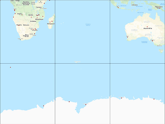
The map below shows in red the location of each processed point between April/2009 and August/2020. In the South and Southeast regions of Brazil, point coverage is dense, showing the increased search for the service for georeferencing activities.
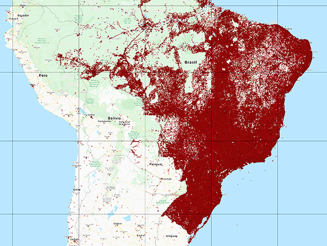
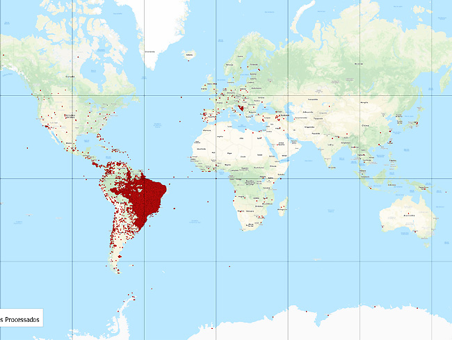 Each red point represents a coordinate search processed by the app
 Each red point represents a coordinate search processed by the app
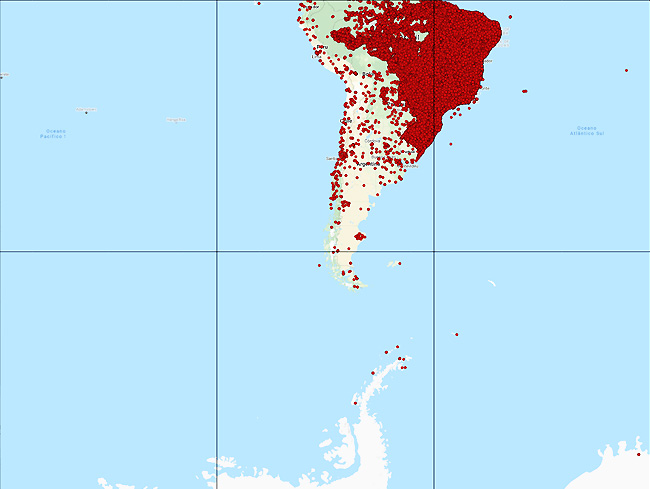 Each red point represents a coordinate search processed by the app
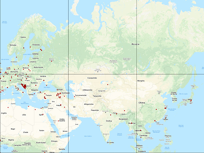 Each red point represents a coordinate search processed by the app
The first version of the application was available for the public in April/2009. The system makes use of the processing application CSRS-PPP, developed by the Geodesic Division of NRCan (Natural Resources of Canada). The IBGE offered the system license for its use in national territory, by means of the National Geospatial Infrastructure Project (PIGN), a result from the partnership between the Institute and the University of New Brunswick, in Canada, supported by the Canadian International Development Agency (CIDA) and the Brazilian Cooperation Agency (ABC).
Em 25 de fevereiro de 2005, o Sistema de Referência Geocêntrico para as Américas (SIRGAS2000), compatível com o GPS, foi oficialmente adotado como a nova referência para o Sistema Geodésico Brasileiro (SGB) e para o Sistema Cartográfico Nacional (SCN).
Defining the Geocentric Reference System for the Americas (SIRGAS)
On February 25, 2005, the Geocentric Reference System for the Americas (SIRGAS2000), compatible with GPS, was officially adopted as the new reference for the Brazilian Geodesic System (SGB) and for the National Cartographic System (SCN).
Since 2015, after a transition period of 10 years, only information generated with SIRGAS2000 as a geodetic system has been considered official. This decision was made in the scope of the Geodesic Reference Change Project (PMRG), formed in 2000, managed by the IBGE and formed by work groups with representatives of public and private institutions, universities and users that makes use of georeferenced information.
A geodetic system is a coordinated system, used to represent terrestrial characteristic, either geometric or physical. In practical terms, it is used to obtain coordinates (latitude, longitude and altitude), which enables map representation and the localization of any elements on the planet.
The main difference between SIRGAS2000 and the previous reference systems in Brazil is that the latter are topocentric, which means that the system’s origin and orientation are settled on Earth's surface. Whereas, SIRGAS2000 is geocentric, which means that its origin is located in the Earth's center.
With the geocentric reference, it is possible to directly use the GPS technology, a more appropriate tool to update maps, to control the of transportation companies, and also air, sea and land navigation in real time. Among the coordinates produced by the old reference and SIRGAS2000, there is spatial displacement of thousands of meters, depending on the locality.


