Geomorphology
IBGE releases Field Guide based on technical excursion to the Paraná Plateau


October 07, 2024 10h00 AM | Last Updated: October 08, 2024 03h12 PM

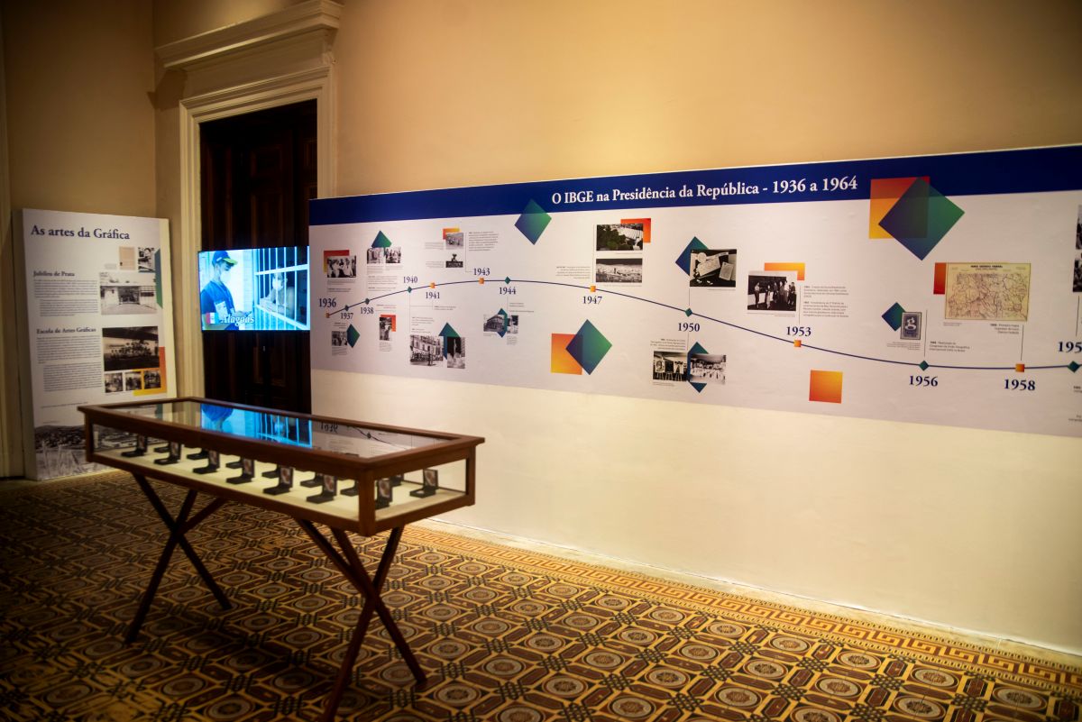
The Brazilian Institute of Geography and Statistics (IBGE), to celebrate the International Geodiversity Day (6), releases the Brazilian Relief Classification System (SBCR) from the series Technical Excursions: Field Guide for the First Relief Classification Meeting (I RCR), at the Paraná state plateau.
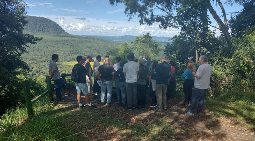
“For the first time in the history of Brazilian Geomorphology, a technical excursion was organized gathering relief experts in the country, with the objective of identifying, discussing and classifying the forms of relief adopted by the SBCR,” explained the technical coordinator of the publication, Rosangela Botelho.
Planned together with the 2nd Workshop on the Brazilian Relief Classification System, organized by the Land Sciences Department, at the downtown campus of the Polytechnic Center of the Federal University of Paraná (UFPR), in the city of Curitiba (PR), the First Relief Classification Meeting was held on March 02 and 03, 2023, between the first and second days of the event.
Promoted by the Department of Geography and by the Graduate Program in Geography of UFPR, the meeting was focused on the Paraná plateaus. The I RCRA had a total of 26 participants from 17 different institutions, from the Southeast, South, Northeast and Central West of the country.
"To bring together experts in Brazilian relief in the field, on the sites that we would like to talk about, having the chance to observe, see the features, and to have discussions based on our observations and opinions was a landmark in terms of geomorphology,” said the geographer Rosangela Botelho.
According to Rosangela Botelho, at first the IBGE used to have many field trips Around the country, making investigations and mapping the territory, and that has no longer been so frequent in recent years.
"With the First Relief Classification meeting, we recovered part of that, in a new format, and strengthened the partnerships built with the SBCR, with the Geological Service of Brazil and with Brazilian universities and researchers. We could exchange experiences, knowledge, concepts and methodologies. The IBGE should be open to speak with the scientific society. We have gotten closer to the academy, so that our products can be used by them," she added.
The route covered during the excursion followed two strategic directions. On the first day, departing from Curitiba, heading for the west up to Guarapuava, then crossing the First Plateau, the Second Plateau and the third Plateau. On the second day, also departing from the capital, heading north up to the Bacaetava Cave Municipal Park, in an karst area; then up to Morro da Cruz (Cross Hill), for an open view of the Curitiba Plateau, and, finally, heading towards the dry plateaus located in the area of Ribeira Valley, in the municipality of Rio Branco do Sul.
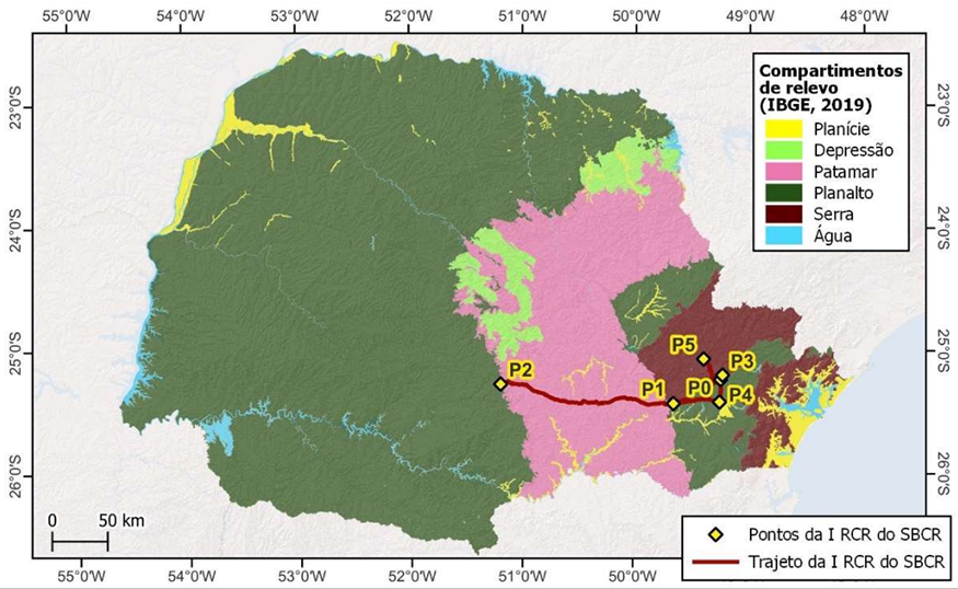
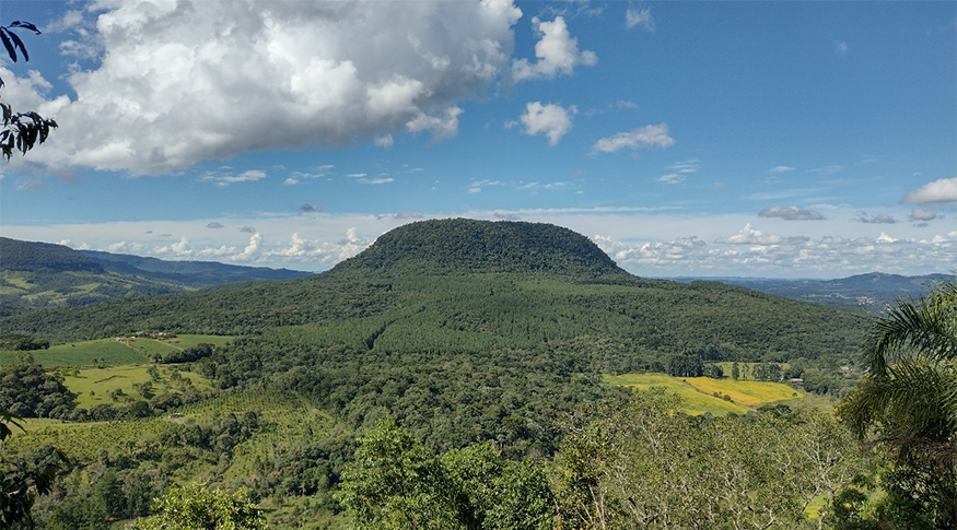
Rosangela explained that the state of Paraná is characterized by the three plateaus. The state also has a coastal plain and mountain features, represented by Serra do Mar (Sea Mountain Range). But the plateaus are distinctive of the the state. “Our first excursion had the objective of defining how we can make a difference between the plateaus within the SBCR.”
Rosangela also explained that the inspiration to create this event came from the successful Editions of the Brazilian Meeting of Soil Classification and Correlation (RCC), promoted by the Brazilian Soil Science Society (SBCS), with the support from several institutions associated to the Brazilian Soil Classification System (SiBCS).
The RCCs, which stared in 1978, and with their 15th edition expected for this month in the Amazonas Valley, have been a reference for the creation, update and adequacy of the SiBCS to the variety of soils in Brazil.

The First Relief Classification Meeting (I RCR) adopted a working dynamics with the SBCR to develop the technical scientific bases and the history of relief in Brazil. We hope future meetings can take place together with workshops about the SBCR or as requested by the National Executive Committee (CEN) and by members of the SBCR e and that this Field guide will become a reference on plateau relief, for several purposes, such as research, teaching and science tourism.
"We intend to acquire experience with this first Meeting so that we can have others in different parts of the country, in other reliefs and with bigger groups, so that we can reach recognition of the variety of reliefs existing in our country and their classification based on the field, where they are found. To have that recorded is to record the history of the IBGE’s environment department and of Brazilian geomorphology," she added.