Cartography
IBGE launches Political Map of Brazil with updates after the 2022 Census


June 28, 2024 10h00 AM | Last Updated: June 29, 2024 09h09 PM
Highlights
- IBGE publishes updated Editions of the Political Maps of Brazil at the 1:2,500,000 and 1:5,000,000 scales. These maps are cartographic representations of the entire Brazilian territories and present the administrative and political division of Brazil.
- One of the innovations in the 2023 edition of the Political Maps of Brazil the inclusion of data obtained from the 2022 Population Census. The information refers to Federation Units and residents, and had previously been obtained from the 2010 Population Census of population estimates.
- The target audience of these maps consists of education professionals, students, public institutions and society as a whole.
- For the update of maps the Institute made use of changes in the 2023 version of the Continuous Census Mapping of Brazil at the 1:250,000 scale (BC250).
- Versions of the Political Maps of Brazil at the 1:2,500,000 and 1:5,000,000 scales will be released Every three Years, approximately, according to update made on the basis used as a reference and the demand for printed versions.
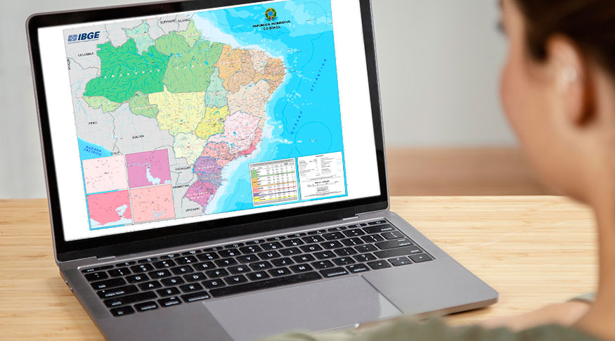
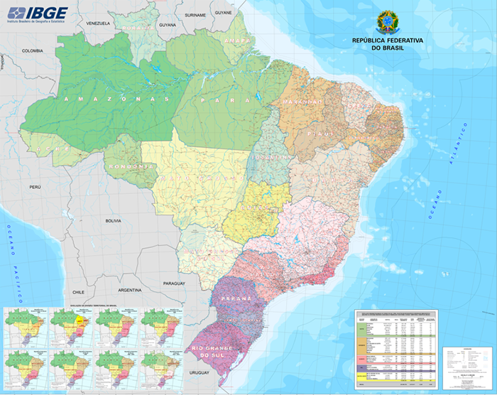
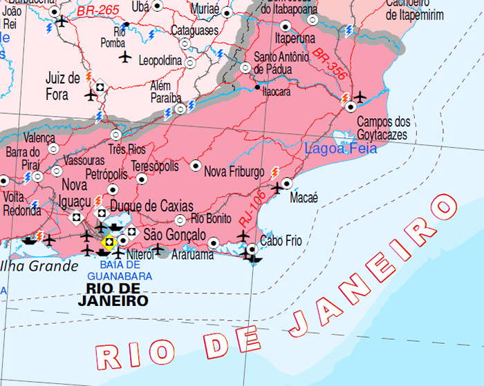
The IBGE makes available today, 28, the 2023 edition of the Political Maps of Brazil at the 1:2,500,000, scale, where 1cm is equivalent to 25 km of the land, and 1:5,000,000, scale, where 1cm corresponds to 50 km. As cartographic representations of the entire Brazilian territory, the maps illustrate the political and administrative Division of Brazil, including the 26 states and the Federal District. They also show the headquarters of Brazilian municipalities and additional cartographic information.
The main innovation of these new editions is the presence of information from the 2022 Population Census. The data are relative to Federation Units, their capitals, resident population, territorial area, total of municipalities and population density, and the Federation Units are grouped by Major Regions. In the editions of 2013 onwards, these statistics are related to the 2010 Population Census or according to population estimates.
This time features not mapped the last time were also included. They refer to elements that integrate the air, road and railway systems, and other ones related to the Generation of energy, such as new power plants. Besides, there was the standardization of the names of geographic features, for example water courses, localities, hills and roads existing in the territory.
As these are wall maps, public institutions, education professionals, students and society in general are the potential users of these products. The maps are available as GeoPDF files, Metadata can be found at the IBGE catalogue.
“With these maps, we intend to portray Brazil the best way possible using these scales. It is important for society to have access to updated information about the territory and obtained from the 2022 Census, such as the total population of the country and the states,” says Ludolf da Mota, head of the IBGE’s Map Design and Publishing Department. According to him, the main challenge observed in the process of map elaboration is the cartographic generalization for the selection and later assembling of elements represented by cartographic conventions by means of symbols, colors, styles and patter fills that guide user’s comprehension.
Having been developed after the 2023 version of the Continuous Census Mapping of Brazil at the 1:250,000 scale (BC250), the products released today provide an overview of the territory. Due to its dimension (1.80m x 2.26m), the 1:2,500,000 scale map represents the headquarters of all the 5,568 municipalities, besides the State District of Fernando de Noronha and the Federal District. The map at the 1:5,000,000 scale, which is smaller (0.90m x 1.15m), represents the headquarters of the municipalities selected for this scale.
On the maps it is possible to identify the following categories:
Hydrography: water bodies and islands;
Transportation systems: : roads, railways, ports and airdromes;
Localities: classified according to the population. In the case of the map at the 1:5,000,000 scale, where it is not possible to represent all the headquarters of municipalities, there were only those corresponding to more central municipalities in the region, according to the urban areas to which they belong;
Boundaries: international (informative), state, districts and sea;
Energy and communications: plants;
Reference points: extreme points;
Relevo: montes e picos;
Toponímia: segundo os critérios estabelecidos pela Gerência de Nomes Geográficos (GNG) do IBGE.
The Political Map of Brazil at the 1:2,500,000 has been produced by the IBGE since 1940. It has portrayed the evolution of the territorial division of the country from the first release up to the current political administrative division. That is the biggest map produced by the Institute, displayed in rooms of institutions of the different government spheres. Although it is produced in only one size, due to its particular dimensions, the map was subdivided into four quadrants, equally published, in order to facilitate printing by users and the subsequent assembling.
The maps, both at the 1:2,500,000 and at the 1:5,000,000 scales, are usually released every three years. The updates include those in the census mapping that generates the maps and the demand for printed versions.