Cartography
IBGE launches new edition of Political Map of Brazil
September 26, 2022 10h00 AM | Last Updated: September 26, 2022 02h20 PM
Highlights
- The IBGE produces the Political Map of Brazil in the 1:5,000,000 scale since 1940.
- It provides an overview of the territory, allowing to pinpoint the Federation Units, their capitals and other geographic elements.
- Public institutions, education professionals, students and society in general are potential users of this product.
- It is launched every 5 years.
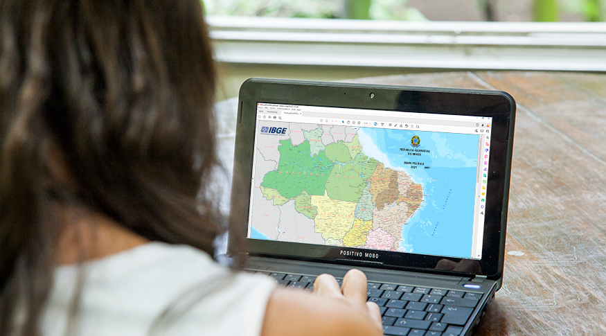
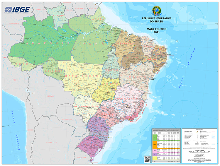
The IBGE released today (26) the new edition of the Political Map of Brazil, version 2021, in the 1:5,000,000 scale, in which 1 cm in the map corresponds to 50 km in the terrain. The products shows the political-administrative organization of Brazil through its 26 states and the Federal district, as well as the capital of the municipalities selected to be represented in that scale. The last edition of the map occurred in 2016.
“The periodicity of this product is every 5 years, taking into account the updating of the database that originates the map and demands for printed versions. The last version was produced in 2016. As an exception, a version was made available in 2020 exclusively for printing and distribution. Due to operational restrictions imposed by the COVID-19 pandemic, it was not printed,” explains Sonia do Nascimento, the IBGE´s manager of Preparation and Publication of the Coordination of Geodesy and Cartography (CGC).
Leila Freitas, manager of Cartography at the CGC, analyzes the major changes occurred in the publication over the last five years. “The major difference between the 2016 version and the current one is in the cartographic base used as reference to produce it, more detailed and updated in 2021, which is the Continuous Cartographic Base of Brazil in the 1:250,000 scale (BC250). The updating basically involve elements associated with the generation of energy, airport, road and rail systems, as well as the standardization of names of the geographic features. The map also brings an updated table listing the Federation Units, their respective capitals, resident population estimated for 2021, territorial area, total number of municipalities and population density, as well as groups the FUs according to the Brazilian Major Regions”, clarifies her.
The IBGE´s manager of Cartography also assesses who can be the major recipients of the publication.
“As it is a wall map, public institutions, education professionals, students and the society in general are potential users of this product. It provides an overview of the territory, allowing to pinpoint the Federation Units and their capitals, as well as other geographic elements that complements and characterizes it,” assesses Freitas.
The cartographic information portrayed in the map is classified into eight categories: Hydrography: water bodies and islands; Transportation System: highways, railways, ports and airfields; Localities: classified according to the population In regions where it is not possible to represent all the localities in that scale, those of higher population are portrayed; Limits: international (informative character), state and district, and nautical lines; Energy and communications: power plants; Reference points: extreme points; Relief: mountains and peaks; and Toponymy: according to criteria established by the IBGE´s Department of Geographic Names (GNG).
The 2021 version is available for download in GeoPDF format and their metadata can be found in the IBGE´s metadata directory.


