New edition
IBGE updates Geographic Framework for Statistics on interactive platform on interactive platform


July 27, 2022 10h00 AM | Last Updated: July 29, 2022 01h28 PM
Highlights
- IBGE publishes second edition of “Geographic Reference Framework for the Production, Analysis and Dissemination of Statistics”.
- The product gathers technical sheets and thematic maps of legal and institutional territorial sections of the country.
- The Framework can also be accessed on the Interactive Geographic Platform (PGI), which allows consulting information on sections and their interactive maps.
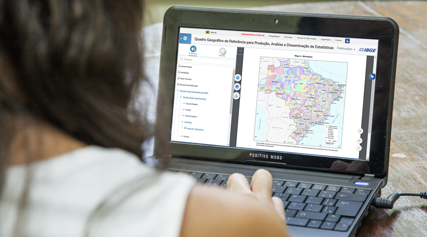
The IBGE updates today ( July 27) the Geographic Reference Framework for the Production, Analysis and Dissemination of Statistics, which gathers the thematic maps of the legal and institutional territory sections of the country. The first edition was published in 2019.
“The main goal of the Geographic Framework is to provide users with a coherent spatial reference for access, visualization, analysis and understanding of official statistics in Brazil, in a comparable and spatially integrated way”, explains IBGE geographer Mauricio Gonçalves e Silva.
“With the inclusion of the Geographic Framework in the Interactive Geographic Platform (PGI), information can be consulted as interactive maps, with other layers of interest, downloading the sections and checking their metadata", says IBGE manager of Production Integration for Geoinformation, Aline Lopes Coelho.
For each geographic section of the Framework, information is presented such as the update cycle and the last update of the legislation/definition, the number of related units and municipalities, the reference publication/legislation and the date of the next release.
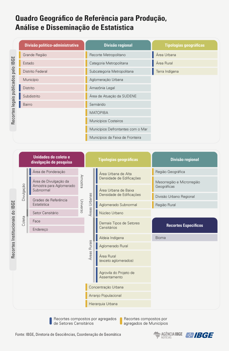
The product is composed of two major groups. In the legal territorial sections published by the IBGE, the following are included: the political-administrative division (Major Regions, State, Federal District, Municipality, District, Sub-District and Neighborhood), the regional division (Metropolitan Section, Metropolitan Category, Metropolitan Subcategory, Urban Agglomeration, Legal Amazon, Area of Operation of SUDENE, Semiarid Region, MATOPIBA, Coastal Municipalities, Municipalities Facing the Sea and Municipalities in the Border Strip) and the geographic typologies (Urban Area, Rural Area and Indigenous Land).
The IBGE's institutional territorial sections are divided into: survey collection and dissemination units (Enumeration Area, Weighting Area, Sample Dissemination Area for Subnormal Agglomerates, Statistical Reference Grids, Blockface and Address), geographic typologies (Urban Area of High-Density Buildings, Urban Area of Low-Density Buildings, Rural Area (excluding Agglomerates), Urban Core, Subnormal Agglomerate, Rural Agglomerate, Indigenous Village, Agricultural Villages of the Settlement Project, Other Type of Enumeration Areas, Population Arrangement, Urban Concentration and Urban Hierarchy), regional division (Geographic Region, Geographic Mesoregion and Microregion, Urban-Regional Division and Rural Region) and specific section (Biome).
The Geographic Framework also allows you to retrieve previous versions of some sections, which helps the user to understand their evolution process.


