Geodesy
Report shows 20-year monitoring of geographic coordinates


December 16, 2021 10h00 AM | Last Updated: December 16, 2021 05h35 PM
Highlights
- Methodological report presents an assessment of the position of RBMC stations from 2000 to 2019.
- Monitoring makes it possible to determine the dynamics of the earth's crust, local movements, effects caused by earthquakes, as well as displacements due to changes in equipment and to unidentified events, in addition to height variations.
- Data are essential for carrying out infrastructure works, climate studies, georeferencing of properties, energy generation and transmission, precision agriculture, land demarcation, among others.
Twenty years of movements of the earth's crust, recorded by means of determining coordinates and velocity in 189 monitoring stations with GNSS (Global Navigation Satellite Systems) equipment. This is what we can see in the report called Solução Multianual das Estações da Rede Brasileira de Monitoramento Contínuo dos Sistemas GNSS no período de 2000 a 2019 (Multiannual Solution of Stations of the Brazilian Network for the Continuous Monitoring of GNSS Systems, in the period 2000 to 2019), which the IBGE publishes today (December 16).
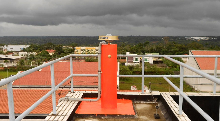
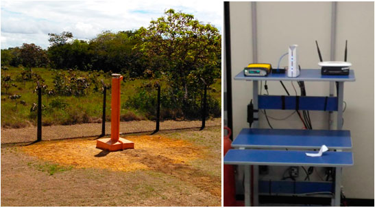
The Brazilian Network for Continuous Monitoring (RBMC) is formed by a set of geodetic stations equipped with high-performance GNSS receivers. Once a day or in real time, these high-precision antennas provide observations for determining precise coordinates. “This allows us to monitor the variation of the coordinates over time and express it as velocity. Thus, we can observe the movement of tectonic plates”, explains IBGE geodesy manager, Ms. Sonia Maria Alves da Costa.
The methodological report presents an assessment of the position of the RBMC stations over time, taking into account the dynamics of the earth's crust, local movements, the effects caused by earthquakes, as well as displacements due to equipment changes and to unidentified events, in addition to variations in height, such as those that occur in the Amazon, resulting from hydrological loading.
“The equipment makes it possible to estimate this variation in height during periods of drought and flooding in rivers. When it rains, the mass of water causes the crust to sink. The variation can reach eight centimeters over one year. This also occurs in icy regions of the planet: with the thaw, the load exerted by the weight of the ice decreases and the crust relaxes and rises over time”, exemplifies Ms. Costa.
Determining the coordinates of precision, latitude, longitude and height is essential for carrying out infrastructure works such as hydroelectric plants and bridges, national and global climate studies, georeferencing of rural and urban properties, energy generation and transmission, precision agriculture, land demarcation, among others.
The report also describes the procedures for combining the homogeneous weekly solutions from data reprocessing. “RBMC's observations are carried out daily, but the solution determined is carried out weekly. This process makes the result more precise and homogeneous, reducing errors from daily files. Therefore, over 20 years of data, 1,043 weekly solutions were generated, which were later combined to determine a multiannual solution”, clarifies IBGE's planimetry supervisor, Mr. Alberto Luis da Silva.
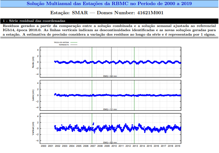
2010 earthquake in Chile and by antenna changes in 2007 and 2013.
This multiannaul solution is represented by a set of coordinates relative to January 1, 2010, a set of velocities, and the time series of each station. The results obtained were evaluated in accordance with internationally adopted standards and guidelines.
Learn more about the RBMC.


