Urban Green Areas
IBGE launches methodology proposal for mapping of Urban Green Areas in Brazil


September 08, 2025 10h00 AM | Last Updated: September 09, 2025 12h12 PM
Highlights
- Experimental study introduces methodological discussion for the mapping of Urban Green Areas.
- Guarulhos (SP) and Palmas (TO) were the Brazilian municipalities adopted as test areas for the identification of Urban Green Areas.
- The investigation aims to spark debate among researchers and those interested in the topic so that a methodology can be implemented all over Brazil in the future.
- With the initial Urban Green Area data base, the use of artificial intelligence could generate a more automated mapping update.
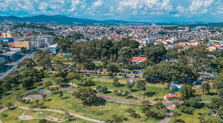
The Brazilian Institute of Geography and Statistics (IBGE) launches, this Monday (8) a new proposal for mapping Urban Green Areas in Brazil. The experimental investigation presents a methodological discussion to the public, with an initial study in two Brazilian municipalities. Guarulhos (SP) and Palmas (TO) were chosen as test areas because they are regionally different, both in terms of city formation and of climate and vegetation.
Based on this investigation, the team from the IBGE's Directorate of Geosciences (DGC) intends to assess, with other researchers and interested parties, a methodological proposal that can be implemented nationwide in the future, as detailed by Manuela Mendonça de Alvarenga, technical manager of the study.
"It's important for us to launch this study on an experimental basis so that we can discuss the proposed methodology, test its applicability to different contexts, and, based on feedback from other researchers, managers, and other stakeholders, propose something that can be applied throughout Brazil," said Manuela.
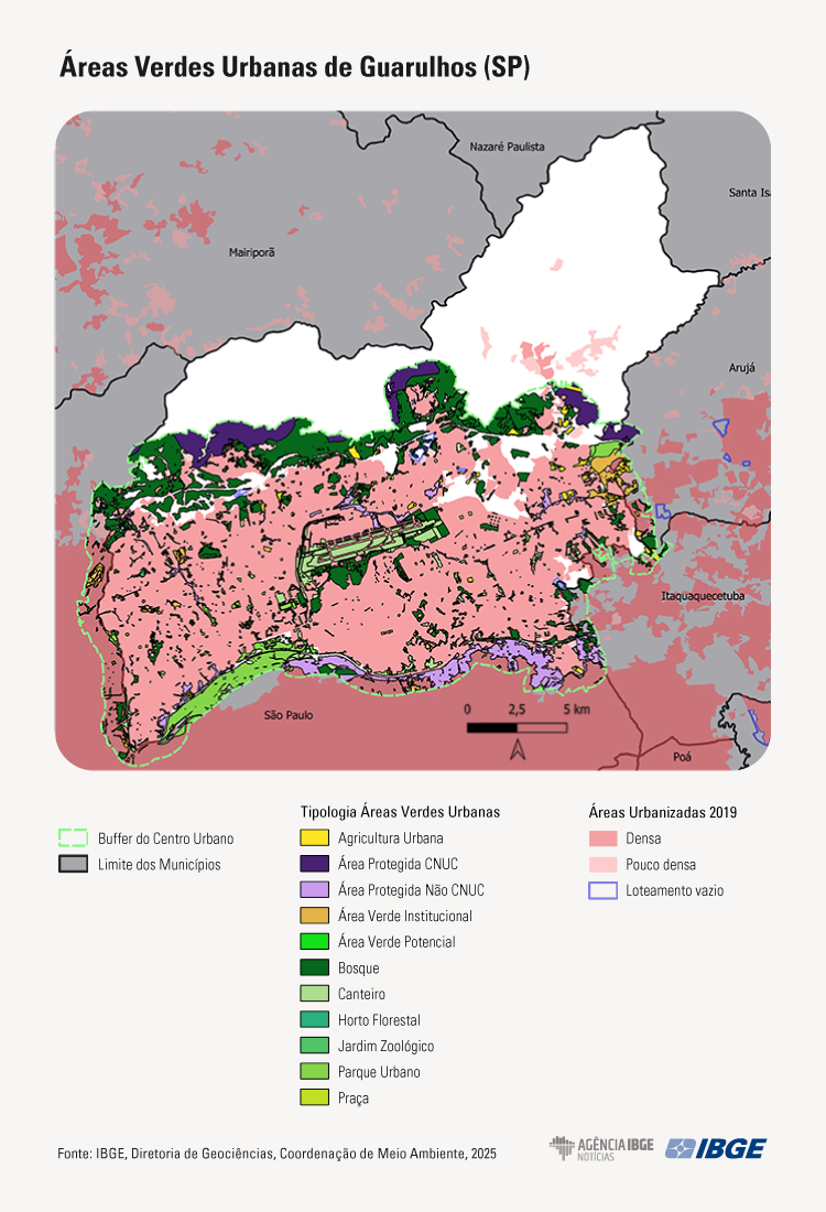
The methodology adopted in this investigation used the definition of Urban Green Areas from the Brazilian Forest Code, which covers public or private areas of (natural or restored) vegetation —which have a purpose in urban planning beyond subdivisions and housing—with the intention of providing ecosystem services to the city. The classification of green areas followed the proposal of the Ministry of the Environment and Climate Change, encompassing parks, squares, flowerbeds, among others, and the services they can offer, such as recreation and climate regulation. For the mapping area, delimitation follows the UN-Habitat international standard based on population density and population size in continuous areas. Furthermore, the use of collaborative cartography data, which indicate the presence of diverse green areas, was proposed. These data were used as input for preliminary identification, cross-referenced with satellite imagery, which indicated the presence of vegetation.
In Guarulhos, 7,096.37 hectares of Urban Green Areas were identified, representing 45% of the city's urbanized areas, taking into account the 800m area surrounding the urban center. Regarding intra-urban green areas, the figure drops to 6,036.73 hectares, bringing the proportion to 38% of the city's urbanized areas.“"With this result, we can interpret the level of impact that the urban center's surroundings have on the composition of the city's green area and, consequently, on the services rendered to the population," explained Manuela.
In Palmas, the total Urban Green Areas amounted to 5,137 hectares, considering the mapping area within 800 meters of the urban center, accounting for 49.11% of the city's total urbanized areas. Considering only the intra-urban area, Urban Green Areas totaled 977.99 hectares, representing approximately 10% of the municipality's urbanized area. The decrease of about 80% in green areas between the intra-urban and peri-urban areas is due to the fact that Palmas has large areas of riparian forests along rivers tributaries to the Tocantins River that cross the city. These areas are not considered urbanized due to their large area without dwellings or built-up areas.

With the results obtained from the experimental investigation and future improvements, the technical team intends to propose a methodology suitable for green areas throughout Brazil. It also has 2022 as a reference year, due to the availability of inputs and the possibility of cross-referencing with data from the latest Population Census. In the future, this study will be able to monitor updates of the IBGE's Urbanized Areas and complement this mapping with a jointly established frequency. Also, having an initial starting point allows for more optimized use of artificial intelligence for updates, as explained by the lead researcher.
"The mapping was proposed considering the availability of inputs and the simplicity of processing, and with this, we can achieve quality data for all of Brazil. Thus, based on a first version and its validation, the mapping itself can serve as input for training artificial intelligence algorithms, which could enable more automated mapping updates," she concluded.


