Em Brumadinho e região
New geospatial data show area hit by dam rupture


February 15, 2019 10h00 AM | Last Updated: February 15, 2019 05h32 PM
The IBGE released today (14) new geospatial information on the region hit by the rupture of one of the dams of Feijão Mine, in Brumadinho (MG). Based on up-to-date satellite images, the delimitation of the affected area and the boundaries and localities of the 17 municipalities around Paraopeba River are already available, as well as the river course and the reservoirs of the hydroelectric plants of Três Marias and Retiro Baixo. Click here to access the files and here for complementary explanations on the material.
All the geospatial information on the region of Brumadinho (MG) are in kml format, which can be viewed on Google Earth through the following path: Configurações > Ativar importação de arquivos kml and then Meus lugares > Importar arquivo kml downloaded in your device). The material is also available in csv and shp formats for expert users, which can be read by different cartographic software.
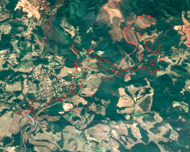
The update of the municipal mesh of the whole country is scheduled to be released by the IBGE in March, yet the information on the area hit by the collapse has been anticipated to help the studies on the impacts of the dam rupture and spread of waste.
"The images show the municipalities that still can be hit by the waste, as well as the two near reservoirs. We produced the geospatial data of that area for the persons at least have a notion of the localization of the waste and its course up to January 29", explained Miriam Barbuda, advisor of the IBGE´s Directorate of Geosciences.
Coordinates of agricultural establishments released in January
The IBGE had already released on January 28 the positioning of the agricultural establishments in the region, obtained from the 2017 Census of Agriculture, as well as the paths covered by the enumerators during its data collection. Barbuda stressed that the satellite images previously obtained by the IBGE showed many clouds, precluding a precise delimitation, and that such difficulty was overcome by the most recent photos.


