Risk Areas
Unprecedented study shows residents prone to floods and landslides


June 28, 2018 10h00 AM | Last Updated: June 28, 2018 12h35 PM

In 2010, more than 8 million persons lived in areas of potential risk of flood and landslide in 872 Brazilian municipalities. It was unveiled by the Population in Risk Areas in Brazil unprecedented study, released today by the IBGE. Salvador was the city with the highest concentration of persons in this condition, 1.2 million, which corresponds to 45% of its population. São Paulo, with 674.3 thousand residents and Rio de Janeiro, with 444.9 thousand, ranked in the second and third positions, followed by Belo Horizonte and Recife.
It is the result of a technical cooperation agreement signed in 2013 between the IBGE and the National Center for Monitoring and Early Warnings of Natural Disasters - CEMADEN. The study is part of a multi-sector effort to avoid tragedies like the one in January 2011 in municipalities of the mountain region of Rio de Janeiro, which caused the death of more than 900 persons, affected more than 300 thousand residents and caused economic losses of about R$4.8 billion.
Ranking of municipalities with population in risk areas
| Municipalities | Persons in risk area | |
| 1 | Salvador (BA) | 1 217 527 |
| 2 | São Paulo (SP) | 674 329 |
| 3 | Rio de Janeiro (RJ) | 444 893 |
| 4 | Belo Horizonte (MG) | 389 218 |
| 5 | Recife (PE) | 206 761 |
| 6 | Jaboatão dos Guararapes (PE) | 188 026 |
| 7 | Ribeirão das Neves (MG) | 179 314 |
| 8 | Serra (ES) | 132 433 |
| 9 | Juiz de Fora (MG) | 128 946 |
| 10 | São Bernardo do Campo (SP) | 127 648 |
| 11 | Natal (RN) | 104 433 |
| 12 | Fortaleza (CE) | 102 836 |
| 13 | Santo André (SP) | 96 062 |
| 14 | Guarulhos (SP) | 94 720 |
| 15 | Vitória (ES) | 87 084 |
| 16 | São João de Meriti (RJ) | 86 185 |
| 17 | Blumenau (SC) | 78 371 |
| 18 | Petrópolis (RJ) | 72 070 |
| 19 | Maceió (AL) | 70 343 |
| 20 | Igarassu (PE) | 69 801 |
According to Claudio Stenner, IBGE´s Coordinator of Geography, the geomorphological characteristics of Salvador coupled with the high concentration of the population take the capital of Bahia to lead the ranking of the population at risk. "The city has hills and valleys, so the occupation is made on the slopes, which are prone to landslides, and in the valleys, which are prone to floods. The less favorable areas are those remaining for the population with the worst socioeconomic conditions", explained him.
The study points out that 9.2% of the population in risk areas were children under five years of age and that 8.5% were seniors over 60 years of age. In the North Region, 13% of the population in risk areas comprised children under 5 years of age and 6%, seniors. In the Northeast, the vulnerable population comprised 9.1% of children and 8.4% of seniors. In the Central-West, they were 9.7% of children and 8.4% of seniors and, in the South, the population in risk areas had 8.7% of children and 9.7% of seniors.
According to Regina Alvala, acting Director of CEMADEN, the identification of children and seniors is paramount, as they are considered the most vulnerable age groups to disasters. "Children, seniors and disabled persons should be the priority in case of accidents, when warnings are issued by the civil defense of the municipalities", stated her.
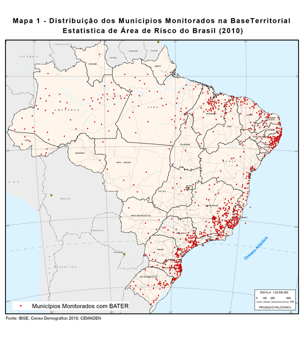
According to Claudio, the IBGE work consisted of creating a methodology that coupled the territorial base used in the Institute surveys with the 2010 Population Census data. As a result, a new territorial division was created, called Statistical Territorial Base of Risk Areas - BATER.
"The cooperation between the IBGE and CEMADEN generated a new product, aggregating knowledge from both institutions, which will be invaluable for public policies to reduce the population in risk areas in Brazil. It will save lives", concluded Claudio Stenner.