Divide to know: the regional divisions of Brazil
January 09, 2018 02h00 PM | Last Updated: February 26, 2019 12h49 PM
Citing the names of the five Brazilian Major Regions and pointing them on a map may be an easy task for most people, but does someone know to explain what defines each one of them? Who knows whether Brazil was always divided like this?
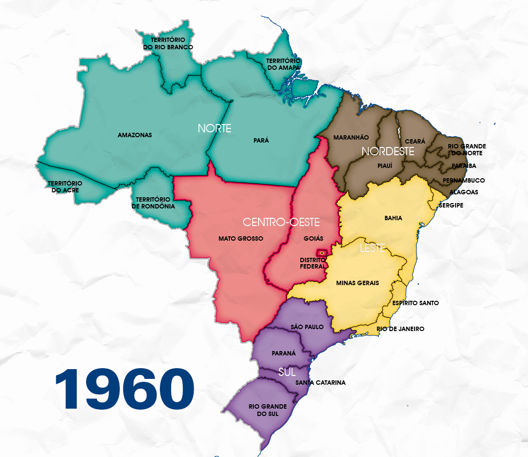
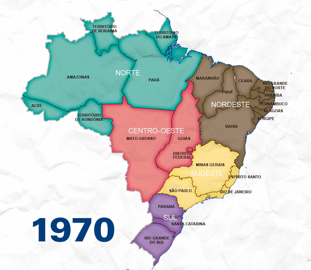
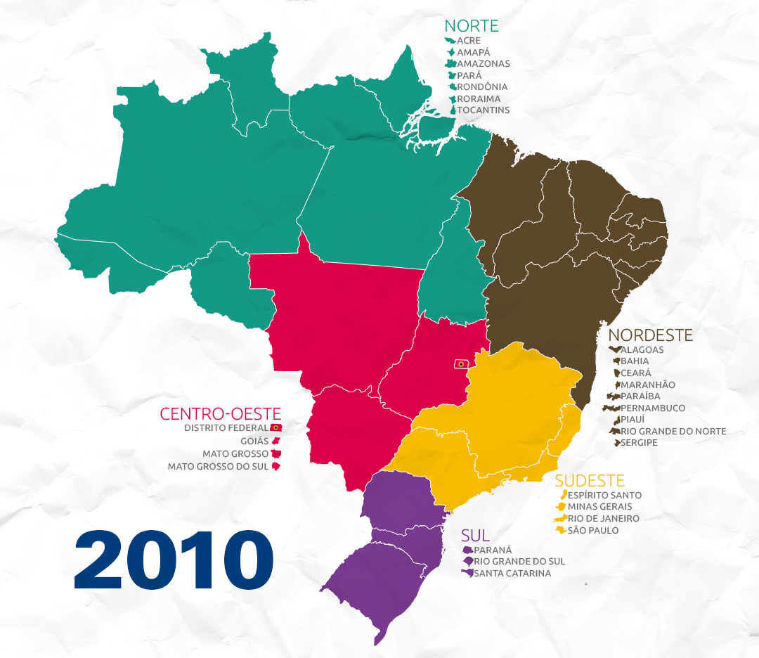
The maps published in this story of the Retratos Magazine no. 6 show that Brazil has always been divided into regions that grouped geographically close states, yet these groups were not always the same.


Map produced by the IBGE in 2010
The current division of Brazil into five Major Regions – North, Northeast, Central-West, Southeast and South – was created in the 1970s and suffered occasional changes: the creation of the state of Tocantins, whose territory belonged to the state of Goiás, located in the Central-West, and the division of Mato Grosso, which originated Mato Grosso do Sul. Maranhão, Piauí, Bahia, Sergipe and São Paulo are examples of Federation Units that changed their regional positioning over time. Check the full story in the Retratos Magazine to know more about all the regional divisions ever used in Brazil.
Text: Marcelo Benedicto and Mônica Marli
Design: Pedro Vidal


