RBMC
IBGE inaugurates five new stations of the Brazilian Network for Continuous Monitoring; publishes time series of geodetic networks
December 09, 2024 10h00 AM | Last Updated: December 09, 2024 03h31 PM
Highlights
- Five new stations of the Brazilian Network for Continuous Monitoring of the Global Navigation Satellite Systems (GNSS) are located in the following municipalities: Governador Valadares (MG), Maceió (AL), Januária (MG), Pinhais (PR) and Nova Friburgo (RJ).
- Currently, the IBGE has 150 stations integrated to the RBMC, which is part of the IBGE’s Coordination of Geodesy.
- The updated time series for the Brazilian Network for Continuous Monitoring of the GNSS Systems - RBMC and the Geodetic Permanent Tide Gauge Network - RMPG were also published today.
- The consolidated time series for the RPMG are updated every year and the change in average sea level is published here under the section “Data Analysis”.
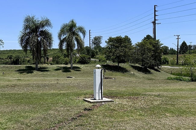
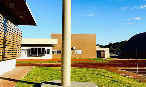
The Brazilian Institute of Geography and Statistics (IBGE) inaugurates today (9) five new stations of the Brazilian Network for Continuous Monitoring (RBMC) of the Global Navigation Satellite Systems (GNSS) for precision geo-referencing. The new stations are located in the following municipalities: Governador Valadares (MG), Maceió (AL), Januária (MG), Pinhais (PR) and Nova Friburgo (RJ).
With these inclusions, the RBMC now counts with 150 stations, being MGGV (Governador Valadares/MG) and ALMC (Maceió UFAL/AL) replacements of old GVA1 and ALMA stations, respectively. The update of the time series of the stations of the Geodetic Permanent Tide Gauge Network (RMPG) and RBMC stations was also launched today.
Maira Kronemberg, the Coordinator of Geodesy, explained that "this release reinforces the role of the IBGE as the office in charge of the maintenance and update of the geodetic data, key to the Brazilian Geodetic System. It shows the IBGE´s commitment in providing high-precision information, key for activities of environmental monitoring, major engineering works and modernization of the Brazilian reference systems. Moreover, the integration with international networks, like GLOSS and SIRGAS-CON, strengthens the global cooperation and highlights the importance of Brazil in the geodetic studies."
As part of the RBMC Modernization and Improvement Project, which aims at strengthening the capacity of precision geo-referencing in Brazil, all the new stations are equipped with multi-constellation receivers, able to collect data from GPS, GLONASS, Galileo and Beidou constellations, as well as make data available for download in the RINEX 2 and RINEX 3 formats. Moreover, the five stations work in real time, transmitting data in RTCM 3.2 (MSM) format via NTRIP through the RBMC-IP caster service. The ALMC station also provides data with 1 second tracking interval.
"The five new stations integrate the RBMC Modernization and Improvement Project, increasing the network density and improving the coverage and precision of geo-referencing in the covered regions. As a result, more users have access to high-quality GNSS data," pointed out Guiderlan Mantovani, manager of Planimetric Reference Networks.
The operation and maintenance of RBMC stations is a duty of the IBGE’s Coordination of Geodesy, in partnership with State Superintendencies, universities and public institutions. The GNSS data made available daily on the IBGE portal are public and free, being used in activities such as the demarcation of urban and rural property, precision agriculture, scientific research and studies about sea level variation on the coast.
Time series of the Geodetic Permanent Tide Gauge Network
The IBGE releases today (9) the time series of the Geodetic Permanent Tide Gauge Network as well. Geodesy is a science able to precisely measure positions and variations that occur on the terrestrial surface. The two active geodetic networks operated by the IBGE monitor the variations that occur three-dimensionally in a point of the terrestrial surface, as well as the variations that occur in the sea level, producing the respective time series.
The consolidated time series of the RMPG are updated on an annual basis, according to the criteria adopted in the report "Monitoring the variation of the Average Sea Level in Stations of the Geodetic Permanent Tide Gauge Network - RMPG 2001-2020." The single series for each Tide Gauge Stations is produced from the daily data provided by the IBGE on its page, including the proper amendments of instrumental failure and reference height of sensors (offset). The time series of the variation of the average sea level obtained in the period between July 2001 and December 2023 can be accessed on link.
The RMPG stations, comprising six tide gauge stations that monitor the differences between the current average local levels and the vertical datum, also integrate the Global Sea Level Observing System (GLOSS), coordinated in Brazil by the Directorate of Hydrography and Navigation (DHN) of the Brazilian Navy and they are key to cartography, coastal engineering and studies of modernization of the Brazilian heights. The information is transmitted nearly in real time (every five minutes) and directly contributes to the sub-network of Tsunami Warning in the Caribbean.
The RBMC stations, which are part of the Regional Reference Network SIRGAS-CON (Geodetic Reference System for the Americas), are a partnership among American countries and it is one of the most precise networks in the world, allowing the continuous monitoring of the station coordinates. The weekly processing allows to identify regional and local displacements, like the movement of tectonic plates and altimetric variations caused by the hydrological load in Amazon. These movements or variations are represented by means of time series of the coordinates, available on link SIRGAS-IBGE Processing Center.
"As part of the strategic project of improving the RBMC, it is expected to inaugurate two more stations in 2025, focusing on the major population arrangements in Brazil. Moreover, the expansion of the network continues even out of the scope of the project, with stations launched either by the IBGE or third parties, strategically addressing the geodetic demands of Brazil," stated Guiderlan Mantovani.
IBGE publishes set of geodetic stations in the Geodetic Database (BDG)
The IBGE also releases today (9) the set of new Level References (RRNN), the GNSS stations connected to the RRNN and the gravimetric stations (EEGG) that were incorporated into the Brazilian Geodetic System (SGB) throughout the year of 2024. The information is published and it is available in the Geodetic Database (BDG).
The published geodetic networks of reference are key to high-precision geo-referencing, which is used in activities of infrastructure in Brazil, like land use, construction of roads, bridges and dams, precision agriculture and implementation and control of public services, like energy, gas and basic sanitation. The networks also serve as bases for the design of maps, geophysical exploitation, environmental management, studies of geo-dynamics and scientific research, among other applications.
The publication of BDG data aims at increasing the gravimetric coverage in the national territory through the measurement of new Gravimetric Stations (EEGG), providing the information for the improvement of the conversion of the heights obtained with the GNSSs into heights compatible with the sea level.
Since the 1940s, the IBGE has been implementing the geodetic networks of reference through geodetic stations distributed in the entire national territory under the form of milestones and abutments installed in the terrain, with the values of height, gravity, longitude and latitude, which are the basis of the Brazilian Geodetic System (SGB).
"The publications highlight the technological advance and the IBGE commitment with the modernization and maintenance of the Brazilian geodetic infrastructure, strengthening these networks as national references of precision and quality," concludes Maira Kronemberg.


