World Soil Day
IBGE´s unprecedented publication shows high natural potential for agriculture in Brazil


December 05, 2022 10h00 AM | Last Updated: December 05, 2022 06h07 PM
Highlights
- “Map of the Natural Agricultural Potential of Land in Brazil” is an unprecedented publication that aims at classifying, interpreting and visualizing the natural potential of the soils for agriculture.
- The date of the release was chosen as it is the World Soil Day, Implemented by the United Nations.
- The wide variety of soil types in Brazil was classified into five potential classes.
- Nearly one third (32%) of the national territory shows either good (30%) or very good (2%) potential for agricultural development.
- 33% shows moderate potential for agricultural development, though with problems which can be easily corrected in some cases.
- The areas with significant restrictions for agricultural development correspond to 21% of the territory.
- The areas with very strong restrictions add up to 11% of the country.
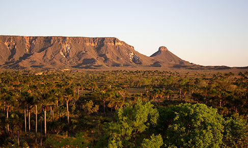
The IBGE released today (5) the Map of Natural Agricultural Potential of Land in Brazil, an unprecedented publication that aims at classifying, interpreting and visualizing the natural potential of our soil for agriculture. This day was chose as it is the World Soil Day, implemented by the Food and Agriculture Organization of the United Nations (FAO). This year, the date has the following theme: “Soils: Where Food Begins.”
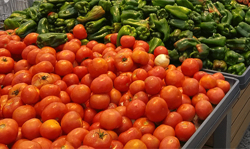
Besides the importance of the day, Daniel Pontoni, an analyst of the survey, highlights the Brazilian position as one of the largest producers of food in the world to demonstrate the importance of the publication. “To attempt to better understand the agricultural potential of the Brazilian soil and its limitations, making a non-indicative analysis of use, but rather interpretative of the soil and relief,” explains him.
The guiding map was developed based on the IBGE´s soil mapping, taking into account the natural resources, especially soil and relief, and how they might favor the Brazilian agricultural sector. The wide variety of soil types in Brazil was classified according to characteristics like texture, stoniness, rockiness and erodibility, among others, into five potential classes, ranging from land with very good potential to land with very strong restrictions to agricultural development.
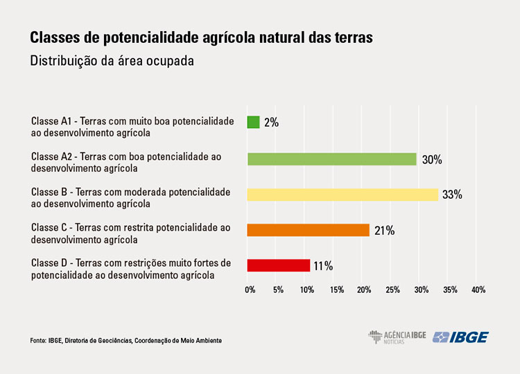
The study revealed that 32% of the national territory shows either a good (30%) or very good (2%) potential for agricultural development. “It means that, under the point of view of the natural resource, as soil types and characteristics associated to relief, these areas favor agriculture, a result that demonstrates the high potential for agriculture in Brazil,” says Pontoni.
Other 33% of the territory shows a moderate potential for agricultural development. “They involve slightly rugged terrains, which might need adequate actions for agriculture, like in the case of shallower soils and mainly with fertility problems, though relatively easy to be fixed,” explains Pontoni.
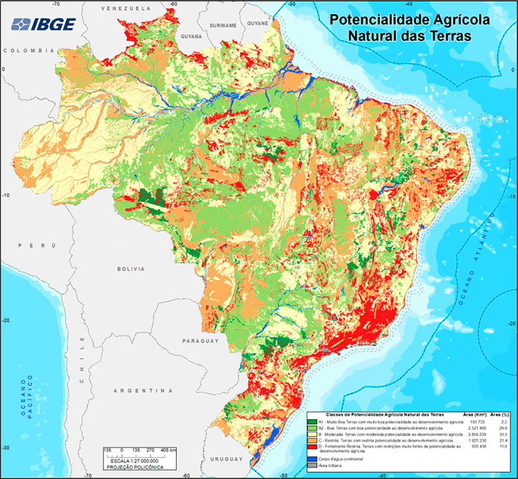
On the other hand, areas with significant restrictions for agricultural development correspond to 21% of the territory. Pontoni states that rugged terrains prevail in these places, with mechanization and fertility problems and important restrictions concerning depth. “These areas require relatively more complex actions of agricultural management and should have a special agriculture adapted to these environment,” complements him.
The last classification is of areas with very strong restrictions to agricultural use, which add up to 11% of the country. The reasons are that they are places in surfaces with sharp slopes and/or presence of undesirable soluble salts and/or important restrictions concerning depth. Planting in these areas requires very intensive and significant actions and, in some places, these lands could be indicated as conservation or preservation areas due to the fragility of the environment. “These are places where agricultural might lead to degradation,” explains the analyst of the survey.
“Due to the scale of the mapping at regional level, it is important to highlight that this map does not apply to local studies of agricultural use, which require a more detailed soil surveying and, consequently, more information. In addition, areas that have any legal attribution should be respected according to established laws,” concludes Daniel Pontoni.