IBGE updates digital index map using a collection of cartographic products


August 24, 2021 10h00 AM | Last Updated: August 25, 2021 12h04 PM
Highlights
- Previous version was published in 2011.
- Fifth edition serves as a reference to identify IBGE cartographic products, either through IBGE's web site or through the Interactive Geographic Platform.
- Among the new products included are the continuous cartographic basis for Brazil and states, as well as regional political and physical maps.
The IBGE releases today (August 24) the 2021 version of the Digital Index Map, with information from the products of the Cartography Coordination of the Directorate of Geosciences. The Index Map serves as a reference to identify and explore different cartographic products, facilitating download access and respective metadata, according to users' interest.
This fifth edition updates the previous version, published in 2011, and include new products to be used by several user profiles, as continuous cartographic basis, satellite image mosaics, image charts, digital elevation models, among others. The 2021 version of the Digital Index Map in GeoPackage to be used in Geographic Information System (GIS) can be accessed here and through geoservice on the IBGE Interactive Geographic Platform.
“We want to facilitate our communication with users”, summarizes IBGE’s general manager of Cartography, Ms. Leila Freitas. “The Index Map shows which products are available in our platform, where they can be accessed and how to get detailed information on them”, she adds. Ms. Freitas reinforces that the representation of territory through cartographic products is crucial for development, territorial management and pubic policy implementation.
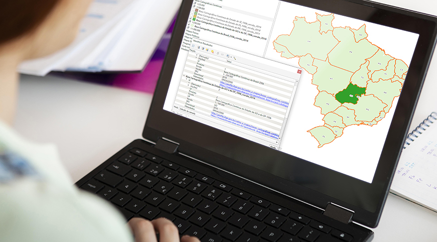 Information as viewed on the 2021 Digital Index Map - Photo: Freepik (art over photo)
Information on different mappings, available scales, reference dates, among others, bring elements for decision-making in relation to IBGE internal projects, as well as to other public and private institutions and by society as a whole. “Besides the IBGE itself, agencies from all government levels, public and private institutions, students, education professionals, professionals from other areas and the general public are users of the Index Map information.”, says Ms. Freitas.
The 2021 version of the Digital Index Map comprises the following products: continuous cartographic basis of Brazil and of its states; image charts; topographic sheets; orthorectified images; maps of geographic indications; Brazil, regional and state maps (physical and political); orthomosaics of aerial photos and satellite images and digital elevation models.
More detailed information on the 2021 version of the Digital Index Map can be accessed in the technical documentation enclosed to the product, available here. The collection also can be accessed on the INDE (National Infrastructure of Spatial Data) Geoportal and the metadata can be found on IBGE Metadata Catalog.