BC100 Project
IBGE releases Continuous Cartographic Base of Acre
June 29, 2023 10h00 AM | Last Updated: July 01, 2023 11h28 AM
Highlights
- Acre is the seventh cartographic base launched in the context of the BC100 project, which has already mapped the states of Alagoas, Espírito Santo, Goiás, Rio Grande do Sul, Sergipe and the Federal District.
- Acre is the first base launched in the context of the BC100 Project that mapped a state in the Amazon region.
- The product is available in free formats (Shape File, GeoPackage and PostGis database dump), for use in Geographic Information Systems and through geoservice, via the Interactive Geographic Platform.
- Continuous Vector Cartographic Base is an essential tool for planning and implementing public policies.
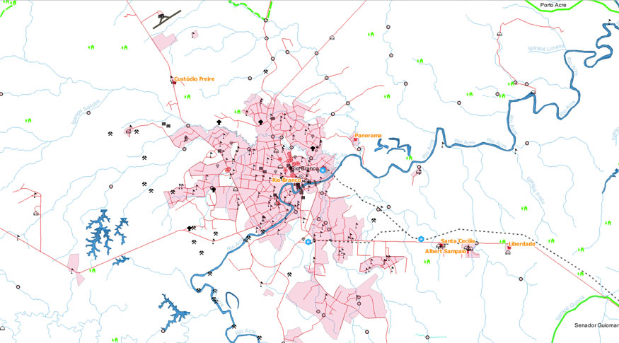
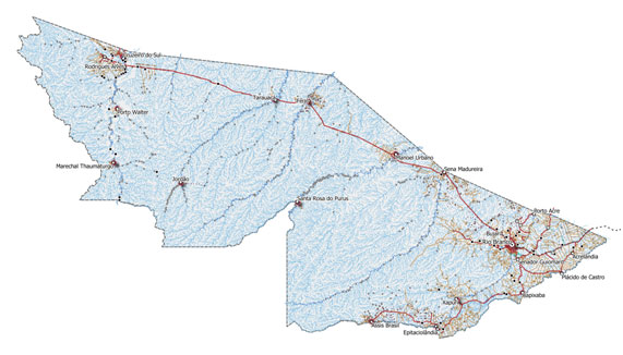
 Acre's cartographic base is the first in a 1:100,000 scale for a state in the Amazon region - Image: Reproduction
The IBGE publishes today (29) the Continuous Vector Cartographic Base of the State of Acre, on a scale of 1:100,000. This is the seventh state, the first in the Amazon region, in the BC100 Project, which aims at mapping all 27 Federation Units on this scale.
The Continuous Cartographic Base is a fundamental tool for government programs focusing on the territory, comprehensive analyzes of the Federation Units and support in the representation of social, economic and environmental aspects of the territory, as well as for the sectoral planning of infrastructure works, such as energy supply, transportation and communications. It is also a source of georeferenced information for researchers, professors and university students.
The remainder is temporarily in Portuguese.
This is the first base of the BC100 Project that mapped a state in the Amazon region. In addition, its development was used as a case study for the design of processes and documentation of the methodology employed. “Work projects were created on the mapping platforms; service instructions were written and workflows were planned, so that the entire production process was registered. The publication of this database also stems from a project to document the productive processes of the Cartography Coordination, of the Geosciences Directorate, which sought to improve knowledge management within the Coordination” highlights the manager of Geodesy and Cartography at the IBGE in Santa Catarina , Juliane Silveira.
“The challenge of mapping Acre was significant due to the Amazon's dense vegetation cover, which required a learning effort to correctly characterize the landscape”, highlights IBGE technologist Flavia Gava. “As the project's reference images are images in the visible light spectrum, the characterization of the drainage sections was especially challenging”, she adds.

Another interesting aspect of this project was the notable importance of the databases produced by the IBGE collection network for other purposes, but which are fundamental for reference mapping.
“The data from the National Address List for Statistical Purposes (CNEFE), regularly updated by the IBGE collection agencies, and from the 2017 Census of Agriculture, produced by enumerators, were extremely important. Such bases had already been used in other BC100 mappings, but in this project, in many cases, it was our only source of information, given the scarcity of information in the most remote locations in the Amazon”, claims the Cartography supervisor of the IBGE in Santa Catarina , Renato Lélis.
“In the municipality of Acrelândia, for example, thanks to a combination of data from the CNEFE and from the Census of Agriculture, we were able to carry out an accurate mapping of facilities intended for agricultural activities. What then to say about the paths taken by enumerators, which indicated the vast majority of occurrences of travel routes under dense cloud and forest cover. Anyone who has ever mapped areas of tropical forests knows how difficult it is to overcome these obstacles”, he adds.
The base was produced from the interpretation of satellite images that cover the territory of the state, information collected by IBGE surveys, cartographic base developed by the Brazilian Foundation for Sustainable Development (FBDS), project Radiography of the Amazon, of the Directorate of Geographic Service (DSG) of the Brazilian Army, in addition to topographic sheets of systematic mapping and information from partner agencies.
The product is available in free formats (Shape File, GeoPackage and PostGis database dump), for use in Geographic Information Systems and through geoservice, via Interactive Geographic Platform. In addition to the mapping itself, the cartographic base also provides an additional layer, the Name Index, presenting the georeferenced names of the elements represented in the base, associated with their respective categories and classes.
Detailed information about the cartographic base construction process is available in the Methodological Note within the product. BC100_AC can also be accessed through the INDE Geoportal and its metadata can be consulted in the IBGE Metadata Catalog (Catálogo de Metadados do IBGE).


