Cartography
IBGE updates map of the Brazilian Geodetic System Networks
December 15, 2021 10h00 AM | Last Updated: December 16, 2021 10h39 PM
Highlights
- The Map of The Brazilian Geodetic System Networks is at the 1:5,000,000 scale, in which 1 cm is equivalent to 50 kilometers.
- It presents the five networks of the Brazilian geodetic system.
- Besides providing a broad view of the distribution of geodetic stations and of the components of these networks in the Brazilian territory, it shows each type of network in three maps at the 1:22,000,000 scale (1cm being equivalent to 220 km).

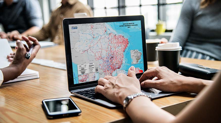
The IBGE has updated today (15) the Map of the Brazilian Geodetic System Networks Redes (SGB) 2021, at the 1:5,000,000 scale – in which 1 cm is equivalent to 50 kilometers. The product is directed to students and professionals in the fields of education, engineering, georeferencing, public management and scientific studies.
The map presents the five existing networks in the Brazilian geodetic system: 1) gravimetric, formed by gravimetric stations, with information about gravity acceleration; 2) altimetric, formed by reference levels, whose precision altitude is obtained by means of geometric leveling; 3) planialtimetric, in turn, formed by SAT stations, whose geodetic coordinates have been obtained from the Global Navigation Satellite System (GNSS).
Besides these three, there are two active geodetic networks: the Permanent Tide Gauge Geodetic Network (RMPG) and the Brazilian Network for Continuous Monitoring of the GNSS Systems (RBMC). The RMPG monitors sea level changes to connect the coastal altimetric systems to the Brazilian Geodetic System and climate studies. This observation is conducted by means of sensors installed in each station.
The GNSS data from the RBMC are used to define precision coordinates, which are essential for several applications, such as precision agriculture, atmospheric studies and demarcation of land, among others.
According to the manager of Systems and Data of the IBGE’s Geodetics and Cartography Department, Aislan Ferreira, the geodetic networks which belong to the Brazilian Geodetic System (BGS), are permanently updated, by means of measurement campaigns and calculations made by the Institute. “Part of the update of these networks is also conducted by society as a whole, by means of the homologation of geodetic marks, whose data are submitted to the IBGE and incorporated into BGS, if the necessary requirements are met.”
The map provides an overall view of the distribution of geodetic stations that form networks in the Brazilian territory, and presents, individually, each type of network, on three maps at the 1:22,000,000, in which one centimeter is equivalent to 220 kilometers. Because of the big number of geodetic stations, the state of Rio de Janeiro, the Federal District and the areas of Florianópolis and Recife stand out, at different scales.
Also according to the analyst, knowledge about the distribution of geodetic stations, either passive or active, allows better planning of users that need official data provided to be used in several fields. “They can be used in order to obtain or transport geographic coordinates (latitude and longitude), altitudes or official gravity figures, for application in engineering works such as dams, hydroelectric plants, irrigation channels and basic sanitation; in transportation systems; map drawing; demographic and population, among many other applications.”
The product has been conceived considering information as of September 2021, obtained from the Geodetic Database (BDG), and of 2016, for the Continuous Cartographic Base of Brazil on the Millionth Scale (BCIM). Complete information on each station in these networks can be found at the BDG Portal. The map is available in PDF and, from this edition on, will carry a QRCode to facilitate the access to descriptive information and the different versions already produced. It will be updated every two years.


