GPS leveling
New IBGE application to convert altitudes improves precision and accelerates calculations
August 05, 2021 10h00 AM | Last Updated: August 09, 2021 03h40 PM
Highlights
- hgeoHNOR2020 model released today replaces MAPGEO2015.
- Accessed on the IBGE Portal, application provides data to convert from geometric altitudes (calculated by GPS) into physical altitudes (that take into account the sea level).
- Average response time is below one second for files with 2 thousand points.
- System is used by professionals who work with altitudes and require a higher precision.
- Webinar on the new model will be held on August 10.

The IBGE launches today (5) an application with a new model to convert altitudes, the hgeoHNOR2020. Besides refining the quality of the results, the tool - accessible only on the IBGE Portal - also provides users with a significant improvement in the performance of the online calculation service. The new model and its application will be presented to the user community of geospatial information in a webinar on August 10 at 2 PM.
Although not known by everyone, there are two concepts of altitude and there is a different calculation for each one. The most common takes into account the sea level and the force of gravity and results in the physical altitude (also called scientific altitude or, in the past, orthometric altitude). The physical altitude is registered in most maps and textbooks. But there is the geometric altitude as well, adopted by satellite systems, like the GPS.
Those who use a cell phone application to find the best way until the destination obtain, through the GPS, the geodetic coordinates known as latitude and longitude. Yet, there is a third positioning information that can also be calculated with the data received from satellites: the altitude. However, the navigation applications of cell phones do not usually provide such information, because the altitudes obtained from the GPS are not measured in relation to the sea level.
Since the 1990s, the IBGE releases models with applications that provide the conversion factor of the altitudes calculated with the GPS (geometric altitude) into values compatible with the sea level (physical altitude). MAPGEO92 was the first application, the result of a joint effort between the IBGE and the Polytechnic School of the University of São Paulo (EPUSP).
After that, new versions of those models and respective applications have been launched periodically, whose technical name is “geoid models”. MAPGEO2015 is the most recent up to now. Like the previous ones, that model was calculated from measurement of the terrestrial gravity made by the IBGE and other institutions, like the National Observatory, the Brazilian Geological Service and the Federal University of Paraná.
“The physical altitudes do respect the hydraulic behavior, because only they reflect the paradigm that water flows from a higher level to a lower level,” explains Roberto Teixeira Luz, IBGE´s manager of Gravimetry and Geoid. “The development of major infrastructure projects and works depends on those data,” emphasizes Luz, adding that the model is widely used by professionals of geodesy and surveying to calculate altitudes with a higher precision.

Advantages of hgeoHNOR2020
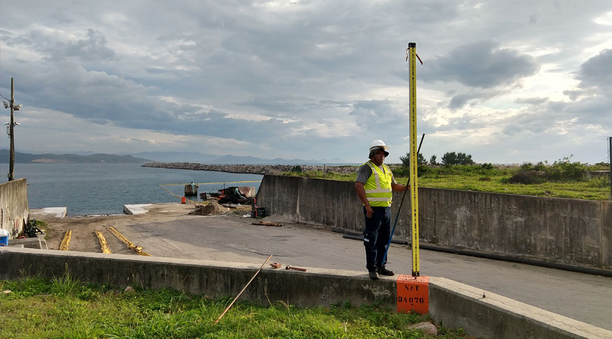
hgeoHNOR2020 allows users to minimize the uncertainty of the conversion of altitudes to less than half in relation to the results of the previous model. Available for use only on the IBGE Portal, hgeoHNOR2020 was developed by means of the integration of the results of MAPGEO2015 and the measurement with GPS and leveling equipment in geodetic stations that also count with high-precision altimetric measurements in relation to the gravity field.
In large part of the Brazilian territory, where the measurements of leveling carried out by the IBGE since 1945 have a suitable spatial distribution, the absolute difference between hgeoHNOR2020 and MAPGEO2015 is less than 50 centimeters. In the case of the Amazon Region, the differences of up to -95 centimeters reflect the difficulties shown by the forest cover to accomplish high-precision altimetric measurements.
Besides the forest cover, the differences of +60 and +80 centimeters between hgeoHNOR2020 and MAPGEO2015, in the specific case of the State of Amapá, also reflect the fact that the physical altitudes refer to the average sea level noticed in the Port of Santana. For the rest of the country, the physical altitudes are counted from the average sea level in the Port of Imbituba, in Santa Catarina.
With the new application, the average response time is nearly one second for files with 2 thousand points. Therefore, huge volumes of information can be submitted expecting a response in few minutes, depending on the Internet connection of users. The technical details of the development of hgeoHNOR2020 are shown in the report available on the IBGE Portal.


