Novel Coronavirus
Against Covid-19, IBGE anticipates data on Indigenous Peoples and Quilombolas


April 24, 2020 09h00 AM | Last Updated: May 11, 2020 12h13 PM
The IBGE estimates that in Brazil there are 7,103 Indigenous localities and 5,972 Quilombolas localities in 2019, according to the Geographic and Statistical Database on Indigenous Peoples and Quilombolas, grounded on the Census mapping for the next Census, postponed until 2021, as well as that for the 2010 Census. Next week, interactive maps and spreadsheets will be available on covid19.ibge.gov.br, a microsite which gathers data to help in the fight against the Coronavirus pandemic.
The dissemination was anticipated to support the development of policies, plans and logistics to face Covid-19 among traditional peoples. The updated data on the contingents of these populations will be known after the 2021 Census.
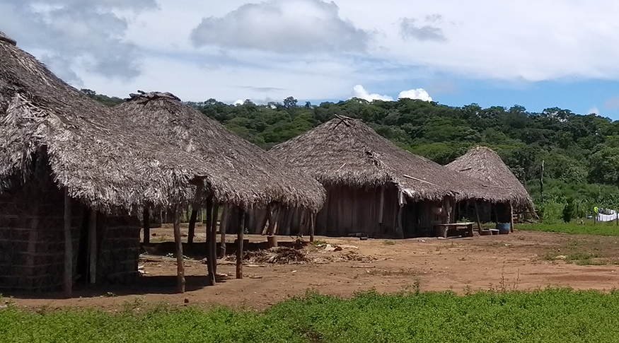
The study shows that Indigenous localities are distributed in 827 Brazilian municipalities. Of the total number of localities, 632 are official Indigenous lands. The remainder constitutes 5,494 indigenous groups, with 4,648 within indigenous lands and 846 outside those territories. The remaining 977 are called other Indigenous localities, those where these peoples are present, but at a minimum distance of 50 meters between the households.
The IBGE classifies as a locality any place in the national territory where there is a permanent population. Groups, in turn, are the set of 15 or more individuals in one or more contiguous homes (up to 50 meters away from one another) and that have family or community ties.
The database also shows that from the 2010 Census to the 2019 estimates, the number of Indigenous localities jumped from 1,856 to 7,103. According to the manager of Traditional Territories and Protected Areas at IBGE, Fernando Damasco, this is due to the improvement of the Institute's technical capacity in identifying these traditional communities in recent years.
“This mapping gives a detailed picture of the Indigenous presence in Brazilian municipalities. It can be used by public bodies and civil society organizations in various actions to fight against the pandemic, since it associates data from the register of Indigenous localities with geospatial and population information generated from the 2010 Census, providing information on the new dynamics of this population in the territory", he says. According to the last Census, there were 896,917 Indigenous persons in Brazil, with 517,383 living on Indigenous lands.
Mr. Damasco points out that the mapping released today focuses on localities. “It is important to highlight that the same community can be constituted of several localities, according to the local territorial characteristics. The complete survey of Indigenous and Quilombola communities will be carried out for specific issues in the 2021 Census ”.

North Region gathers almost two thirds of Indigenous localities
The North is the region with highest number of Indigenous localities, 4,505, accounting for 63.4% of the total. Next are the Northeast, with 1,211, the Central-West, with 713, the Southeast, with 374, and South, with 301 Indigenous localities.
Among the states, Amazonas gathers 2,602 Indigenous localities in the country, followed by Roraima, with 587. Pará accounts for 546 and is the third state in terms of Indigenous localities. Sergipe is the state with the lowest number, four in its total.
Seven out of the top ten municipalities with Indigenous localities are in Amazonas. Sao Gabriel da Cachoeira (AM) is the city with highest number of Indigenous localities, 429 in the total. Alto Alegre, in Roraima, is in the second position, with 149. Pará has also a city in the list: Jacareacanga, with 112 localities.
The North Region also gathers the highest number of officially delimited indigenous lands. There are 305 in the total, of which 148 belong to Amazonas. Mato Grosso (73) is the second state with official lands, followed by Pará (54). There are delimited indigenous lands in all the others regions of Brazil: Central-West (126), Northeast (79), South (77) and Southeast (45).

Quilombolas reside in more municipalities than Indigenous peoples
The Indigenous people started to be accounted for officially in 1872, even before the IBGE was created. The population identified as Quilombolas will be accounted for for the first time in the next Census, postponed until 2021. Although there are no statistics for this population, the IBGE estimates a total of 5,972 Quilombola localities in Brazil, which are spread in 1,672 Brazilian municipalities, more than twice as the number of Indigenous localities (827).
From the total number of localities, 404 are officially acknowledged territories, 2,308 are known as Quilombola groups and the others, 3,260, are identified as other Quilombola localities. Among the groups, 709 are located within the officially delimited Quilombola territory and 1,599 out of those lands.
The Northeast has 3,171 Quilombola localities, more than half of the total. Next comes the Southeast, with 1,359 Quilombola communities. The rest is spread among the North (873), South (319) and Central-West (250) regions.
Bahia has the highest number of Quilombola localities among all Brazilian states. There are 1,046 in the total. Minas Gerais is in the second place with 1,021 communities of the kind. Other highlights are Maranhão with 866 and Pará, which accounts for 516. Acre and Roraima do not have Quilombola localities.
In the Northeast there is also the highest number of officially acknowledged Quilombola territories, adding up to 176 occurrences. However, the majority of officially delimited localities is placed in Pará (75), North. Next are Maranhão, with 60, and Bahia, with 40 Quilombola communities. Among the Major Regions, after the Northeast, are North (94), Southeast (76), South (36) and Central-West (22), also with officially acknowledged territories.
Barreirinhas, in Amazonas, is the city with the highest number of Quilombola localities in the country (167), followed by Alcantara (74) and Itapecuru Mirim (45), both in Maranhão, and Oriximiná (41) and Moju (38), in Pará.
“This is first data estimate about Quilombola communities produced by the IBGE. Since the Institute has never released those kinds of information about this population before, the published data are in still in the consolidation stage, and, so, might be revised until the next Census, in 2012, when they will be then confirmed or not”, highlights Mr. Damasco.

IBGE against Covid-19
Besides those pieces of information about Indigenous and Quilombola communities, the IBGE has already released many survey results, which can be crossed and contribute to the fight against the coronavirus. The microsite, lreleased last week, gathers the data, besides information about partnership with other public entities, as Oswaldo Cruz Foundation (Fiocruz), and the adaptations in the Institute’s routines and projects during the period of social distancing.


