Environmental-Economic Accounting
IBGE depicts natural cover of Brazilian biomes from 2000 to 2018


September 24, 2020 10h00 AM | Last Updated: October 01, 2020 02h06 PM
Highlights
- Brazilian terrestrial biomes lost about 500 thousand km² of their natural cover between 2000 and 2018.
- In absolute numbers, the greatest loss in this period occurred in the Amazon biome (269.8 thousand km²), followed by the Cerrado (152.7 thousand km²), but, in percentage terms, the Pampa was the biome that lost most in natural areas, -16.8%.
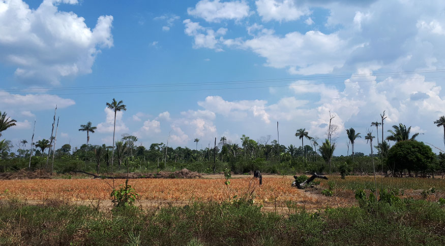
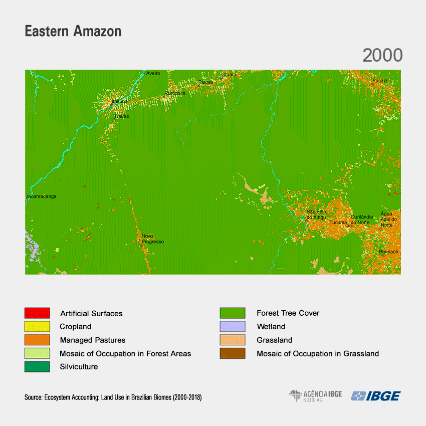
- Forest cover represented 81.9% of the total area of the Amazon in 2000, a proportion that was reduced to 75.7% in 2018. This area was replaced, mainly, by managed pastures, which increased from 248.8 thousand km² to 426.4 thousand km² in that period.
- Between 2000 and 2018, the Pantanal had the lowest losses, both in area (-2.1 thousand km²) and in percentage (-1.6%), but since 2010, about 60% of the changes were from natural grassland areas to managed pastures.
- The Atlantic Forest, which has been longer affected by intense occupation, kept only 16.6% of its natural area, in 2018, the lowest percentage among biomes.
- All Brazilian biomes had a negative balance, but loss has decreased gradually throughout the years, except for the Pampa and the Pantanal.
The Brazilian biomes lost nearly 500 thousand km² of natural cover: from 5.9 million km², in 2000, to 5.4km² in 2018. The greatest reduction of native area took place in the Amazon, which shrank 269.8 thousand km², and in the Cerrado, with 152.7 thousand less km² of natural cover. Together, those losses account for 86.2% of the total. The greatest percentage loss, however, occurred in the Pampa, of -16.8%.
The data are from Ecosystem Accounting: Land Use in Brazilian Biomes (2000-2018), released by the IBGE today (24), as another step towards the insertion of environmental indicators in the National Accounts. The study, developed based on satellite images and field work, presents the preservation profile of the ecosystems and analyzes the remaining natural areas by observing land use in activities such as agriculture, grazing and silviculture.
In 2000, the Amazon biome - the most affected by losses - had 81.9% of its total area with natural cover; however, in 2018, it decreased to 75.7%. Forest tree cover was replaced, mainly, by managed pastures - grazing areas managed by means of specific techniques - which went from 248,800 km² in 2000 to 426,400 km² in 2018.
The study shows that there is a gradual growth of cropland in the region, increasing from 17 thousand km² in 2000 to 66.3 thousand km² in 2018, as explained by the manager of Environmental Accounting and Statistics at the IBGE, Maria Luisa Pimenta.
“The changes in the Amazon indicate the so-called 'settlement belt' pattern: initially very much evident at the edges of the biome - in the neighboring area with the Cerrado; but, nowadays, quite interiorized, in the surroundings of road constructions, river banks and infrastructure works”.
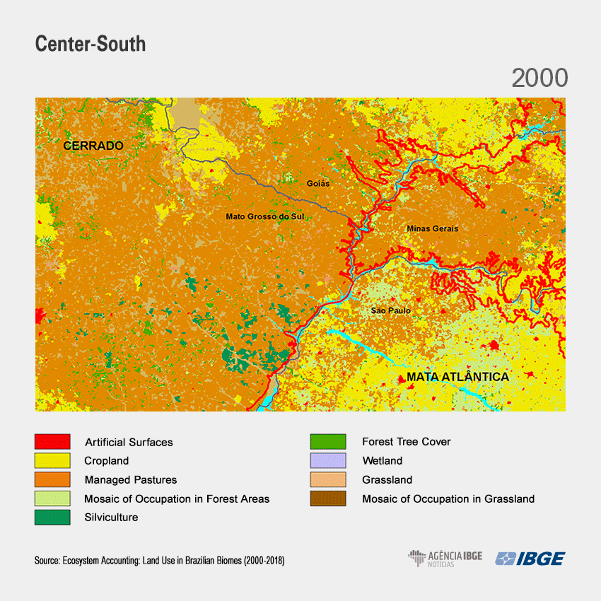
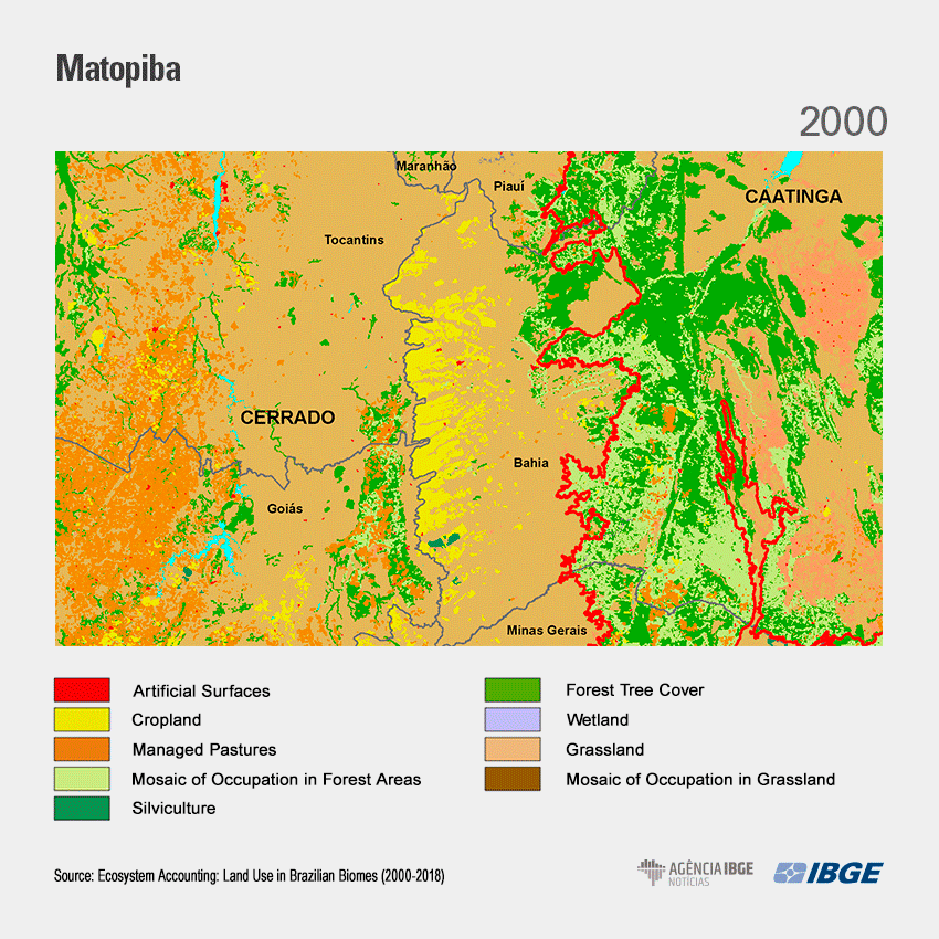
In the Cerrado, there was accelerated expansion of agriculture, which expanded 102.6 thousand km2 in the period from 2000 to 2018, replacing grassland and forest tree cover. In 2018, 44.61% of agricultural areas and 42.73% of Brazil's silviculture areas were in the Cerrado.
According to Ms. Pimenta, agricultural expansion is related to commodities, with two major concentrations: one in the Center-South region (Paraná, São Paulo, Minas Gerais, Goiás and Mato Grosso do Sul), with high investment capacity and good soil; and the other in Matopiba (Maranhão, Tocantins, Piauí and Bahia), an area that has been occupied by soybean, cotton and other monocultures of grains and cereals.
The Pantanal: 60% of the changes since 2010 were of native areas into pastures
The survey also shows that, in 2018, the Pantanal had 87.5% of natural cover (forest tree cover, grassland and wetland) and had the lowest losses both in area (-2.1 thousand km²) and percentage (- 1.6%) from 2000 to 2018. However, between 2016 and 2018, 75.3% of the changes reached the highest level, according to the indicator of intensity of changes used in the survey, which assesses the change degree in land use .
Among the areas changed by human actions since 2010 in the Pantanal, most of them (59.9%) corresponded to the conversion of natural areas into managed pasture. "It is a typical conversion in the biome: the native pasture replaced by grazing managed with agricultural techniques and technologies", says Ms. Pimenta, who explains that the survey does not map out the human actions applied, such as fires, for instance.
The Atlantic Forest: only biome where natural cover does not prevail
According to the study, along the 18 years, there was a slowdown in the loss of natural areas in the country. The greatest deceleration occurred in the Atlantic Forest, from a loss of 8,700 km², between 2000 and 2010, to 577 km² less, between 2016 and 2018. The Atlantic Forest is the only terrestrial biome whose predominance is not of natural cover. In 2018, forest tree cover represented only 12.6% of its territory.
“The natural areas suffered little change in the period because they were already too small. However, they continue to show decrease ”, emphasizes Ms. Pimenta. The Atlantic Forest is the biome with the highest population density in the country, housing 49.3% of the national urban areas in 2018. This results from our occupation and urbanization pattern, from coast to interior, in the formation of the Brazilian territory.
The Caatinga, lowest human interference; The Pampa, significant losses
The study shows that, in 2018, 35.9% of the Caatinga was affected by human interference. The biome had a continuous decrease in its natural cover, and grassland, which predominated in the total area (49.9%) in 2000, had its area reduced by 26.7 thousand km² over the 18 years.
From 2000 to 2018, 47.3% of changes in land use and land cover were related to the conversion of grassland into a mosaic of occupations in grassland. According to the expert, this type of mosaic is quite representative in the region. “There is a large number of small rural establishments, characterized by subsistence crops, small pastures or agroforestry systems”, says Ms. Pimenta.
On the other hand, in the Pampa, where grassland is very abundant (45.4% in 2000), the territory has undergone quite intense changes in recent decades, with the biggest proportional loss of native area. Natural grassland decreased by 15.6 thousand km² between 2000 and 2018. During this period, 58% of the natural areas were converted into cropland, and 18.8%, into silviculture. The study shows that substitutions in the region follow the national trend of investment in commodities, especially soybeans and other grains, but also in food crops, such as rice and wheat.
"All biomes are very different from one another, but the Pampa has a characteristic that makes it less attractive to the public opinion, since it does not have exuberant cover. But it is an important area of sedimentary basins, housing part of the Guarani Aquifer, one of the largest and most important underground water sources in the country ”, claims the specialist.


