IBGE releases list of municipalities in borderland strip (2)


June 22, 2020 10h00 AM | Last Updated: June 22, 2020 11h56 AM
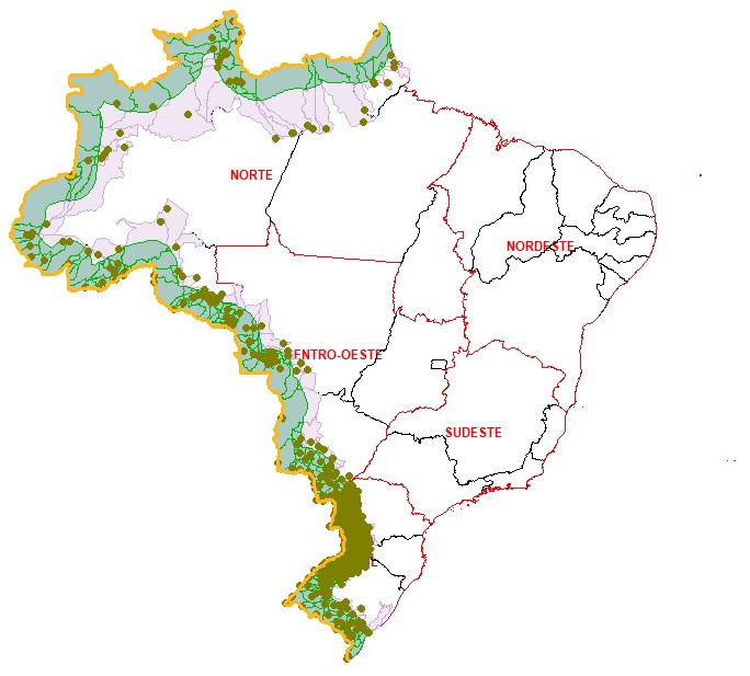
The IBGE released today (22) the list of the 588 municipalities located in the borderland strip of Brazil, including their respective territorial areas. The Brazilian border with the South American countries has 15 thousand km of length, 150 km of width and a total area of 1.4 million km2, including Patos Lagoon and Mirim Lagoon, in Rio Grande do Sul, the equivalent to 16.6% of the Brazilian territory. The digital files of this release can be accessed here.
The municipalities of the borderland strip are under a specific legislation for national security areas (Law no. 6,634/1979, complemented by Decree no. 85,064/1980), which establishes specific financial aids from the federal administration and hinders the granting of public lands or the construction of bridges, roads and airports without previous authorization, as well as the installation of mining companies, for example.
The updating was made based on a set of geospatial operations, resulting in an extensive borderland strip of Brazil, which encompasses 11 Federation Units and 588 municipalities, of which 432 are entirely within the strip and 156, partially. Another particularity is that two thirds of the borderland strip stay in the North Region, highlighted by the states of Amazonas and Acre. The South and Central-West regions also have lands located in the borderland.
The list of Municipalities of the Borderland Strip is a product of the Digital Municipal Mesh of Brazil. The changes introduced in this edition result from the application of more precise and more recent inputs, through geoprocessing tools, and do not involve any changes in the demarcation of Brazilian borders with neighbor countries.


