IBGE launches new version of Physical Map of Brazil


December 06, 2018 10h00 AM | Last Updated: December 06, 2018 11h14 AM
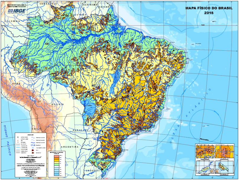
The IBGE releases today the Physical Map of Brazil in the 1:5,000,000 scale (1cm = 50km). Including physical aspects of the terrestrial surface of the Brazilian territory, the map is a wall cartographic representation which brings information on altimetry and physiographic elements of Brazil, like mounts, hills, peaks, mountains and water bodies. The map also presents the political-administrative organization of the national territory, including the 26 states and respective capitals, besides the Federal District. The PDF version can be accessed here.
The Physical Map of Brazil in the 1:5,000,000 scale provides a view of the physiographic characteristics of the territory, allowing the identification of hydrographic macro-basins and major relief structures.
The map was based on the 2016 version of the Continuous Cartographic Base of Brazil to the Millionth - BCIM. A graduation system of hypsometric colors – starting on green, representing the lowest heights, and ending on magenta, representing the highest heights – was used to represent the heights.
Available in printed and digital versions, the map has among its potential users students and education professionals. The last version of this product was produced in 2007.