IBGE concludes mapping of natural resources of Brazilian territory
December 04, 2017 10h00 AM | Last Updated: December 04, 2017 12h16 PM
The IBGE released this Monday the complete set of maps comprising information on Geology (rocks), Geomorphology (relief), Pedology (soil) and Vegetation for the entire Brazilian territory. These are the last 122 maps of the Brazilian territory in the 1:250,000 scale, an unprecedented achievement in Brazil. The mapping will be part of a digital database up to July 2018, available for consultation through the Internet. The information are in vector files of the shape file type, which can be edited in Geographical Information Systems - GIS software, allowing to cross it with different subjects or with information from other institutions. Developed along nearly two decades, the mapping of natural resources of the Brazilian territory subsidizes environmental studies and can be viewed here.
This survey began in the end of the 1990s. The information was consolidated through the interpretation of satellite images, as well as through a number of field works throughout Brazil.
The cartographic scale of 1:250,000 allows a regional level of detailing and inherits the information and methodology of the RADAMBRASIL (Amazon Radar) – started in the 1970s and ended in 1985 – and SIVAM (Amazon Surveillance System) projects. It is a great achievement for Brazil, since few countries in the world have a continuous mapping of their entire territory in this scale. The provision of geospatial data in a classified and interoperable format is another innovation, as it will allow the integration of geoscientific information.
This publication is part of the IBGE´s Surveying of Natural Resources Project, which brings information that subsidizes public policies, as well as contributes to the construction of indicators to follow up the Sustainable Development Goals - SDGs. The use of a single methodology for the Brazilian territory makes these mappings comparable with each other and susceptible to a future integration with other subjects, like the risk of landslides, environmental vulnerability, agricultural potential and biodiversity vulnerability, among others, supporting the environmental planning and the creation and enforcement of the environmental legislation.

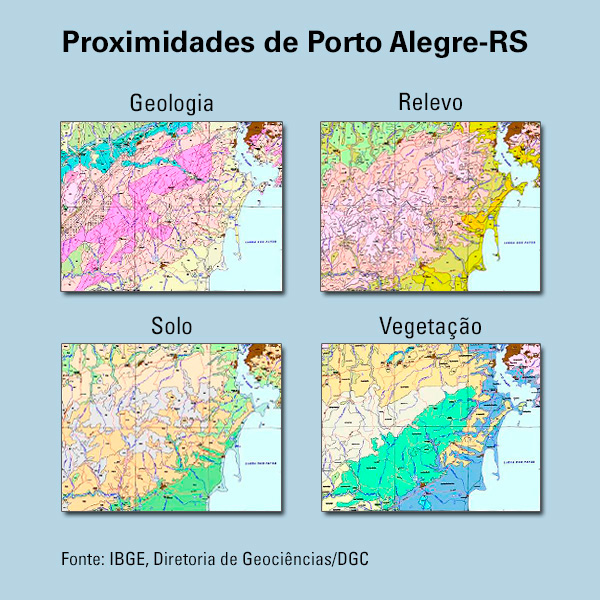
Example of mapping of natural resources
Mapping will integrate digital database on Internet
The four layers of the mapping will be integrated to a digital database up to July 2018, which will be available for consultation of the civil society and of the three levels of the public sector. Enterprises that develop activities related to forestry, mining, agriculture, transportation, energy and communication infrastructure, oil and gas, among others, will also be able to freely explore this information.
Users will be able to access the descriptions of the basic units of the mappings, as well as the punctual data collected in the field by the IBGE researchers and every photographic registration.


