Cartographer's Day highlights tecnological innovation and strategic importance of the field for the IBGE


May 06, 2026 04h31 PM | Last Updated: May 08, 2026 02h32 AM
In 1500, when the letter of Pero Vaz de Caminha was sent to Portugal, reporting information about Brazil, an equally important document was also sent. A navigation force, the Portuguese know a good description of a place depended on well defined coordinates. For that reason, astronomer Mestre João, who was a member of Pedro Álvares Cabral's expedition, determined the lattitude of Baía de Cabrália, currently, Porto Seguro (BA). That was the first cartographic work of Brazil, which motivated the celebration of the Cartographer's Day this Wednesday, May 6.
Officially called cartographic engineer, this professional is a specialist in the collection of geospatial data, the production of maps and the representation of phenomena observed on the Earth's surface. At the IBGE, whose mission is to portray the country, that is a double-function activity: support statistical production and ensure that data will be better understood by society, in the space where we live.

The IBGE's News Agency spoke with two cartographers from different generations and with different paths at the Institute: Eduardo Michalzechen Liberal Xavier, cartographic engineer and a geodesy expert, and Vânia de Oliveira Nagem, a cartographic engineer for over 40 years who is experienced in cartographic bases, toponymy and integration with environment-related topics.
Cartography is maybe one of the fields with biggest transformations in the last few decades. the technological leap — satellites, high-resolution images, geographic information systems, Global Navigation Satellite System (GNSS) — deeply changed the way to map the territory.
Eduardo considers the changes strengthened te profession, although human analysis is still fundamental. “Technoly has only added to that. It has reduced execution time and increased precision. But id does not replace human action."
He recalls that, before the use of GNSS, a survey that would take half an hour to complete used to demand weeks of work and numerous teams and joked. “It was a military exercice.”
More experienced and out of the IBGE, Vânia moniored the imahes of satellite systems, geographic information abd cooperative cartography. Shw saw the profession go through changes withou changing in essence.
 Cartography is maybe one of the fields experiencing the deepest changes in the last few decades
“We started with letters on paér becoming digitsl ones, validating inconsistencies, adjusting rivers, roads, boundaries. It was a careful work demanding a technical and interdisciplinary look.”
Eduardo works with geodesy, the field responsible for defining the Earth's shape, its gravitational field and the references that allow every measure “to speak the same language.” It is an activity that few know, but that everyones uses everyday. “Modern life is only possible because of geodesy.”
As examples of geodesy dependent activities are navigation by applications, precision agriculture, work of oil platforms, instalation of hydroelectric plants, aviation, telecommunications and the launch of rockets. So many services that seem automatic today, that Eduardo warns about the necessity of maintenance of a strong geodetic system. “If that is lost, things may collapse becaue technological dependence is huge."
Vânia has dedicated most of her career to toponymy, the field that studies and standardizes geographic names. To her, the name of a river, a mountain range or a locality is more than a label. “The name carries an indentity. The individual identifies with the territory,” she stated.
She explains that, as she digitizes topographic charts produced over a locality, many times one same rives would be given different names in different sheets. Solving these inconsistencies is part of field work at times. “That is re-survey: going into the field to collect the name the population sees at the name of the place.”
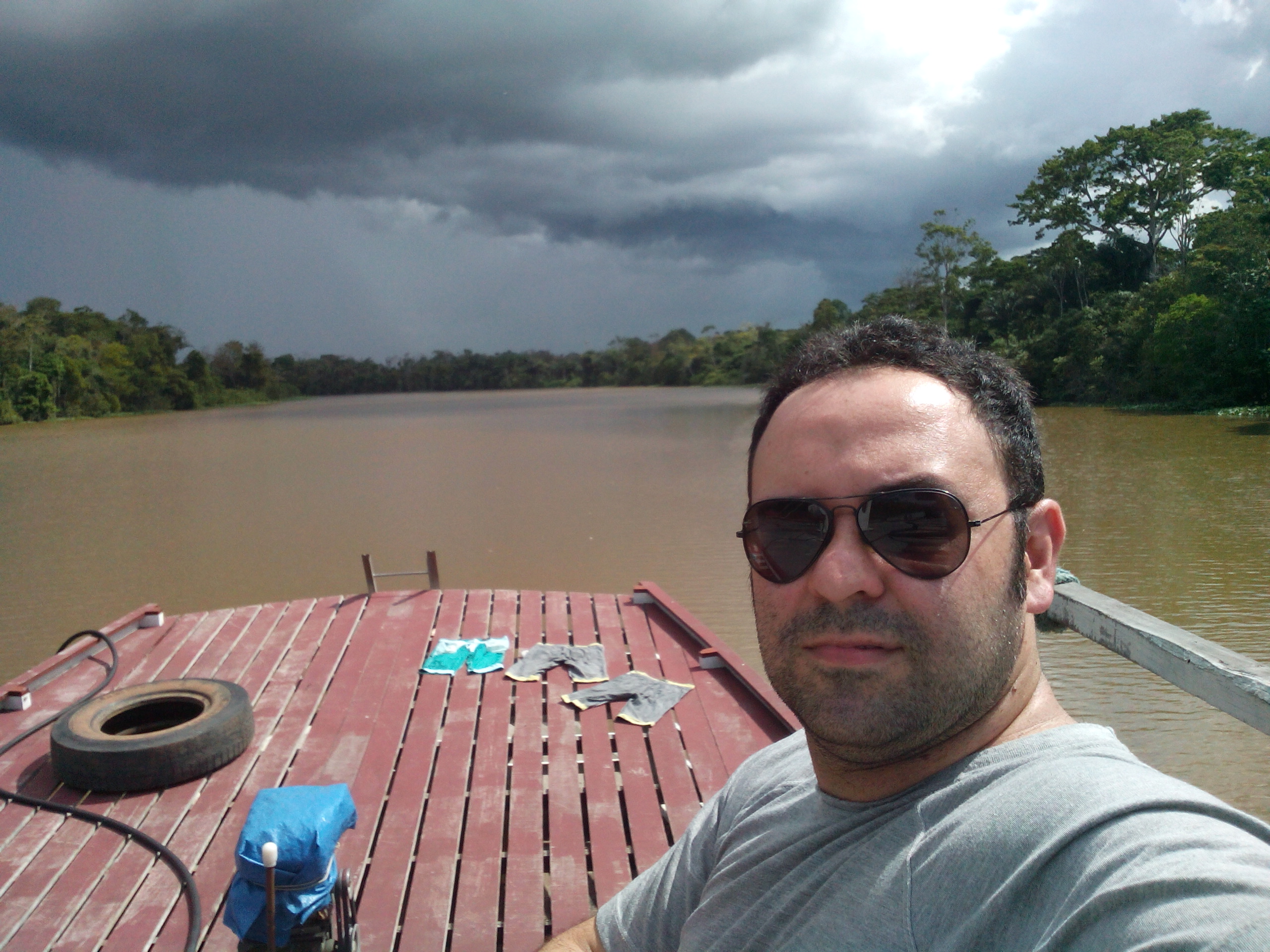
Working for the IBGE since 2010, Eduardo worked for more than a decade with gravimetry, participated in international projects, worked in legal actions related to oil royalties do petróleo and had experiences in the field that could be in a documentary: nights spent on boats in the Amazon; legs covered with mud in Xingu, trips to Oiapoque.
Today, the technical assistant to the Director of Geosciences defines the feeling of many professionals in this field : “For cartography or statistics professionals, being at the IBGE is like being part of the Brazil's national soccer team.”
Vânia joined the IBGE as a hired worker in 1997, and has been a civil servant since 2002. She participated in the Sivam (Amanon Surveillance System) Project, worked in the conversion of topographic sheets, dealt with environmental issues, managed the geographic names department, took a master's course in environmental education and worked in management and planning. Currently, she is Manager of Information Dissemination (GDI).
Her career mirrors the evolution of cartography in Brazil. She understands that integration with society, collaborative cartography, and environmental education, for example, are signs of how the profession is embedded in daily life. “Everything that happens, happens somewhere, sometime,” she replies when asked about the relevance of valued cartographic work in an institute like the IBGE.
With technological changes in full swing and a new space race, Eduardo envisions space frontiers opening up for cartographic engineers. “If they occupy Mars, they’ll put satellites, Mars GPS, imaging satellites, maybe even gravimetric satellites,” he projects.
Cartography is, by nature, a science that works behind the scenes. But without it, the country literally doesn't function. At the IBGE, professionals like Eduardo and Vânia ensure that Brazil is correctly represented—on the map, in the data, and in real life.
On this Cartographer's Day, therefore, we try to acknowledge how essential they are for everything to function, even though, as Eduardo comments, it's actually a good sign that few people remember the cartographer's work: "If the cartography works, nobody sees it. If someone sees it, it's because there was a problem," he jokes.


