IBGE releases new version of Continuous Cartographic Base in 1:250,000 scale


December 12, 2017 10h00 AM | Last Updated: December 12, 2017 11h03 AM
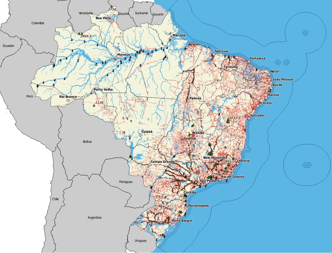
The 2017 version of the Continuous Cartographic Base of Brazil in the 1:250,000 scale - BC250 (1 cm = 2.5 km) included information on the relief and a number of typical products from different localities in Brazil, the so-called Geographical Indications. The base is available in digital format for use by a number of Geographic Information Systems, and can be accessed here.
The Permanent Updating Program of the Cartographic Base aims at providing the society with a set of digital geo-spatial data for the entire Brazilian territory, in the 1:250,000 scale. By including structured, continuous and updated data, this cartographic base also brings the geographical names and the classification of the represented elements.
2017 version brings information on relief and 54 Geographical Indications
The 2017 version of the BC250 was updated from orbital images (RapidEye sensor), which allowed to update a number of information of the version released in 2015. The inclusion of a new category, relief, is one of the major news. Recent field works and inputs from public institutions producing cartographic data also provided subsidies to this update. The inclusion of Geographical Indications was another highlight, locating products or services originated from traditional localities, or products with special characteristics, exclusive from a certain region. Currently, 54 geographical indications have been granted by the INPI, being represented in the Cartographic Base by the IBGE, according to the mapping scale.
The Continuous Cartographic Base for the Brazilian territory in the 1:250,000 scale was built by the IBGE to become a cartographic reference for planning, updating of information on natural resources, monitoring and territorial management.
The BC250 is available in free format (shapefile, geopackage and PostGis dump) for use by Geographic Information Systems and is also compatible with a number of software for reading cartographic data. The new base follows version 2.1.3 of the Technical Specifications for Structuring Vector Geo-spatial Data, including 8 out of the 13 information categories: hydrography, transportation system, energy and communications, water supply and basic sanitation, economic structure, localities, boundaries and relief.