Territorial Structures
IBGE updates municipalities in borderland strip and facing the sea due to changes in limits


July 06, 2021 10h00 AM | Last Updated: July 06, 2021 04h06 PM
Highlights
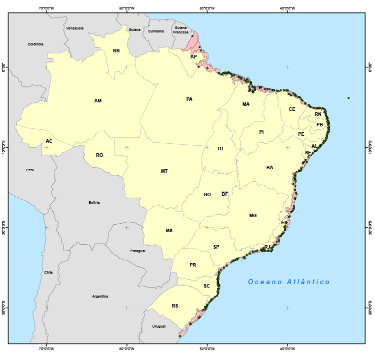
- Brazil has 588 municipalities in the terrestrial borderland strip, representing 16.7% of the national territory (1.4 million km²).
- Width of terrestrial borderland strip is 150 km.
- Terrestrial borderland spans 16.9 thousand km, linking Brazil to 10 neighbor countries: French Guiana, Suriname, Guyana, Venezuela, Colombia, Peru, Bolivia, Paraguay, Argentina and Uruguay.
- North corresponds to nearly two thirds of the entire borderland strip.
- South is the region with the highest number of municipalities in the borderland strip (418), being 196 in Rio Grande do Sul, 139 in Paraná and 83 in Santa Catarina.
- With 10.9 thousand km of shoreline, Brazil has 279 municipalities (more Patos Lagoon in Rio Grande do Sul) facing the sea, representing a surface of nearly 251.3 thousand km² (2.9% of the territory).
The IBGE releases today (06) two products that update the list of municipalities of the borderland strip of Brazil with South American countries and municipalities facing the sea, due to changes in the representation of boundaries. As a whole, the digital files include 588 municipalities of terrestrial borders and 279 accessing the Atlantic Ocean.
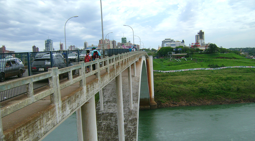
The width of the Brazilian borderland strip with neighbor countries is of 150 km and reaches a total area of 1.4 million km2, the equivalent to 16.7% of the national territory. In terms of length, the terrestrial borderland spans 16.9 thousand km, linking Brazil to 10 neighbors: French Guiana, Suriname, Guyana, Venezuela, Colombia, Peru, Bolivia, Paraguay, Argentina and Uruguay. Of the 588 municipalities in the list, in 435 of them the territory is completely within the strip, an addition of four compared with 2020: Clevelândia (PR), Diamante do Sul (PR), Nova Olímpia (PR) and Itá (SC). The other 153 are partially in the borderland strip, being that 73 have urban concentrations (municipal capitals) in this region.
The IBGE estimated the area in the borderland strip in 1941 for the first time ever. With the new technologies available, the IBGE annually updates the list. “Every year we receive a new legislation from the Federal Units changing boundaries of municipalities. Those changes impact on a number of IBGE products, thus it requires annual updating,” explains Diogo Nunes, IBGE´s manager of Data and Services Infrastructure.
Major Regions and Federation Units did not change, nor the dividing line, according to the Brazilian Limits Demarcation Commissions, of the Ministry of Foreign Relations. Three Major Regions have borderland areas, being the North the largest of them, which corresponds to nearly two thirds of the entire national borderland. However, the South is the region with the biggest amount of municipalities in the borderland strip (418), being 196 in Rio Grande do Sul, 139 in Paraná and 83 in Santa Catarina. The Central-West completes the list, where the largest borderland area is in the state of Mato Grosso do Sul.
Those municipalities meet the parameters of the Federal Constitution and specific legislation, which establish financial aids from the Federal Government and prevent the granting of public terrains or the construction of bridges, roads and airports, as well as the installation of enterprises like mining without previous authorization.

Brazil has 279 municipalities facing the sea
The IBGE also updated the list of municipalities facing the sea. With 10.9 thousand km of shoreline, Brazil has 279 municipalities in 17 states in this condition, as well as the Patos Lagoon, in Rio Grande do Sul. It represents a surface of nearly 251.3 thousand km2, corresponding to nearly 2.9% of the Brazilian territory. The updating also pinpoints the coordinates of the urban concentrations (municipal capitals) and the territorial area of each one of the municipalities.
The measure meets Decree 5,300, of December 2004, and contributes with subsidies to studies and definitions of the coastal zone by the Ministry of Environment, state bodies of environment, regional offices of properties management and the Brazilian Institute of Environmental and Renewable Natural Resources (IBAMA).