Territorial Structures
Geospatial technologies improve border of Brazil with South America


June 22, 2020 10h00 AM | Last Updated: June 22, 2020 03h19 PM
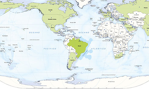
With the use of a set of modern geospatial technologies, the IBGE updated the borderland strip between Brazil and South American countries. The border was improved in the stretch from Uruguay to Bolivia, though without any territory gain for any country.
Considered of national security, that area adds up to 1.4 million km2, the equivalent to 16.6% of the Brazilian territory. The strip has 150 km of width along the 15 thousand km of border with neighbor countries. The borderland strip comprises 588 municipalities, being 432 fully inside the strip and 156 only partially. The data were released today (22) and are available on the IBGE Portal.
Two thirds of the borderland strip stay in the North Region, highlighted by the states of Amazonas and Acre. The South and Central-West regions also have lands located in the borderland. The states of the South are those that concentrate the biggest number of municipalities in the borderland strip, with 196 in Rio Grande do Sul, 139 in Paraná and 83 in Santa Catarina.
"Due to the improvement in the inputs, like high-resolution satellite images, which enhance the visualization of details in the areas, we managed to improve the borderland strip in the stretch from Uruguay to Bolivia," states Roberto Tavares, IBGE´s coordinator of Territorial Structures. He explains that no territory was added or lost in relation to any country, only a more precise delineation of the outlines.
To accomplish these changes with ten neighbor countries, the IBGE queries the Ministry of Foreign Relations´ Commission of Border Demarcation, the office in charge of the demarcation and characterization of Brazilian borders. On the other hand, the updating of the eastern side of the strip is an effort of the IBGE´s state units and agencies in getting information on the updating of the municipality borders.
The current measurement was based on the Geocentric Reference System for the Americas (SIRGAS2000) and the calculation of the areas was geoprocessed. The IBGE had already calculated the borderland strip area in 1941, using technologies available at that time.
IBGE releases list of 280 municipalities facing the sea
Also today, the IBGE released the list of the 280 municipalities facing the sea. The largest country in South America, with a territory spanning nearly 47% of the central-eastern portion of the South American continent, Brazil has 25 thousand km of borderline, being 10 thousand km with the Atlantic Ocean. The territorial areas and coordinates of the municipal capitals are also available in the material released today.