2022 Census
2022 Census: information on population and housing units by enumeration areas helps public management


March 21, 2024 10h00 AM | Last Updated: April 02, 2024 02h45 AM
Highlights
- In the eighth release of the 2022 Population Census, the IBGE presents the total figures for resident population and housing units by preliminary Enumeration Areas and aggregated results by Subdistricts and Districts. Also available today is the Mesh of preliminary Enumeration Areas.
- Information is available on the IBGE website and on the Census Overview Platform, with visualization of interactive maps, direct search by specific locations and filters by one or two districts, subdistricts or enumeration areas of a give municipality.
- By means of the database made available by the IBGE, users have access to a great variety of analyses and studies, considering total population and housing unit figures and the size of enumeration areas, including the average number of residents, population desnsity, comparisons levels of geography, mapping of risk areas, among others.
- As for the mesh of enumeration areas, urban planning and territory management are the most benefited segments.
- In this release, the areas are classified as preliminary because, unprecedentedly, technological advances will allow improvements in the mesh before the final publication of results based on Census data.
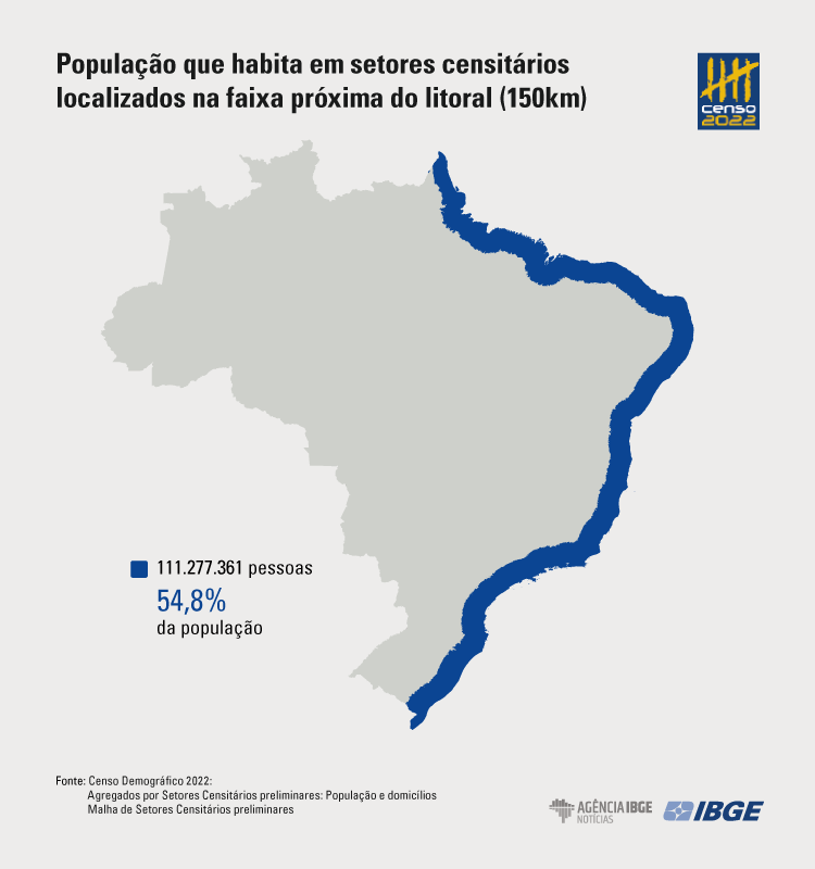
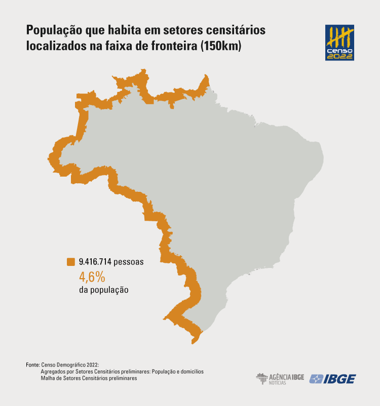
- These data evidence, for example, that in 2022, 54.8% of the Brazilian population (111,277,361 people) lived in enumeration areas located within a maximum distance of 150 km from the shore. And 4.6% of Brazilians (9,416,714 people) lived innEnumeration Areas located within a maximum distance of 150 km from the the border with other countries.
- The data also allow observations on the approximate number of persons living in the surroundings of avenues: in Rio de Janeiro, for example, almost 500 thousand persons lived in enumeration areas located at a maximum distance of 500 meters from Avenida Brasil (Brazil Avenue), along its length.
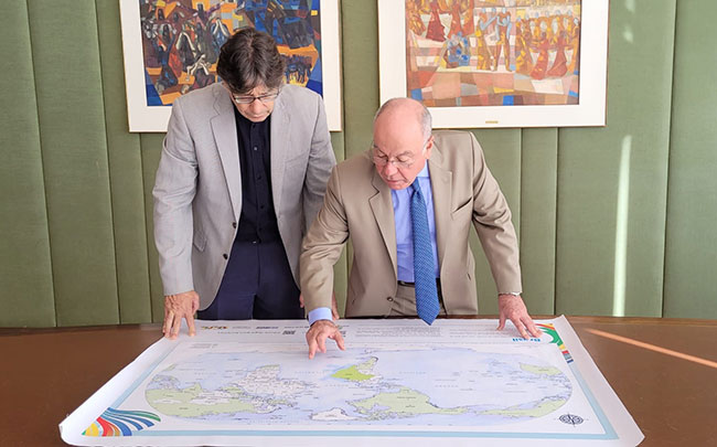
The IBGE has made available today (21) the total figures for resident population and for housing units by preliminary enumaration areas and results aggregated by subdistricts and districts. Enumeration areas are data collection territorial units for the Population Census. Also released today is the mesh of preliminary enumeration areas, with digital vector files by enumeration areas that represent the Brazilian territory. That is a database by means of which it is possible to conduct a wide range of anayses and technical studies, customized accounding to each user’s interests. In Brazil, all the 452,338 enumeration areas are distributed among 5,568 municipalities, besides the Federal District and the District of Fernando de Noronha. The release of the mesh and of final aggregated results is scheduled for the second semester.
The release ceremony takes place today, at 10 am, at the auditorium of the Association of Municipalities in the Great florianópolis Area (GRANFPOLIS), with support from the Federation of Municipalities in Santa Catarina o (FECAM), the Federal University of Santa Catarina (UFSC), the Intermunicipal Regulatory Agency for Sanitation (ARIS) and GRANFPOLIS. The event will be broadcast live on the IBGE website.
| Major Regions and Federation Units | Total | |||||
|---|---|---|---|---|---|---|
| Name | Population | Housing Units | Enumeration Areas (1) | Municipalities (2) | Districts (3) | Subdistricts |
| Brazil | 203,080,756 | 90,704,582 | 452,338 | 5,570 | 10,670 | 643 |
| North Region | 17,354,884 | 6,535,781 | 37,206 | 450 | 695 | 14 |
| Northeast Region | 54,658,515 | 24,446,202 | 115,995 | 1,794 | 3,301 | 71 |
| Southeast Region | 84,840,113 | 38,729,504 | 203,058 | 1,668 | 3,434 | 221 |
| South Region | 29,937,706 | 13,832,757 | 63,529 | 1,191 | 2,487 | 223 |
| Central West Region | 16,289,538 | 7,160,338 | 32,550 | 467 | 753 | 114 |
| Source: IBGE - Censo Demográfico 2022 (1) The vector files of Enumeration Areas encompass operational areas relative to Lagoa dos Patos and Lagoa Mirim. (2) For registry reasons, the vector files of Municipalities, Brasília, the federal capital and headquarter of the Federal District, and the District of Fernando de Noronha are stored as Municipalities. There are also operational areas relative to Lagoa dos Patos and Lagoa Mirim. (3) In the vector files of Districts, there is an operational area relative to Lagoa dos Patos and Lagoa Mirim. |
||||||
“Between the censuses of 2010 and 2022, 135,764 enumeration areas were addded, an increment of 43%, which reflected the increase in the number of constructions. Also, despite the reduction of deceleration of population growth in the last decade, there was an increase of 34% in the number of housing units from the 2010 Census, which is reflected in the mesh of enumeration areas, explains fernando Damasco, a researcher at the IBGE. According to Mr. Damasco, “with the information now available, the analysts can conduct a number of studies, make territory classifications and regionalizations that can be very useful,
Information is available on the IBGE website and on the Census Overview platform, with visualization of interactive maps, direct search by specific locations and filters by one or two districts, subdistricts or enumeration areas of a given municipality.
The mesh is being improved and its final version will have more associated variables
AThe mesh of preliminary enumeration areas is part of the IBGE’s institutional levels of geography, which are listed in the Geographic Reference Chart for production, analysis and dissemination of statistics. It is also available on the Geographic Chart website and on the Geographic Chart’s Interactive Geographic Platform. The enumeration areas presented are considered preliminary, because, for the first time, before the publication of final aggregates, it will be possible to make improvements in the Census mapping, in its shape and classifications based on information collected during the 2022 Census, which was only possible due to technological advances reached in the last decade.
The IBGE has carried out a number of procedures in data editing and adequation of enumeration areas to the territory configuration at the Census date of reference, in order to reach its final format, to reach new statistical aggregates and a bigger number of variables associated with geographies coherent with the results released. In coming months, the Institute will proceed with the data processing and improvement of the mesh of enumeration areas, with the objective of releasing the final aggregatd figures by enumeration areas. This task is expected to be completed by the second semester this year.
“The main purpose of this release is to give society faster access to information at territory level obtained by the 2022 Census, always ensuring the reliability of data. There may be divergence among the features, the boundaries and the attributes represented in the preliminary version and the final one,” says the IBGE researcher Raphael Soares de Moraes. He mentions that comparison between statistics of 2010 and 2022 demands caution, mainly regarding the sectors modified in the period.
Prisons and condos affect the number of residents and housing units
Among so many possibilities of data use made available by the IBGE, some results are worthy of note. In the ranking of most populated enumeration areas in Brazil, Brasília/DF (10,163 persons) and Vila Velha/ES (7,756 persons) were in the first two positions, sectors where, respectively, the Penitentiary Complex of Papuda and the State Penitentiary of Vila Velha are located. The sector with most housing units was also located in Brasília/DF (6,322 housing units), and encompasses, besides country areas, the Itapoã Park. The location had a number of condos with buildings that were empty, being built or remodeled. Among the 76 condos, only four were inhabited and some of the residents were not living in the housing unit on the date of reference (July 07, 2022).
Perdizes, Grajaú and Marsilac stand out among districts in São Paulo
The biggest city in the country, São Paulo had, in 2022, the biggest number of collective housing units in Perdizes (294), the biggest population and number of housing units in Grajaú (384,873 people and 154,205 housing units), and the smallest population and number of housing units in Marsilac (11,443 people and 6,153 housing units).
“The level of detail of infomation that we present now can also be useful in the mapping of risk areas, as those in the north coast of São Paulo,” Mr. Soares remarks.
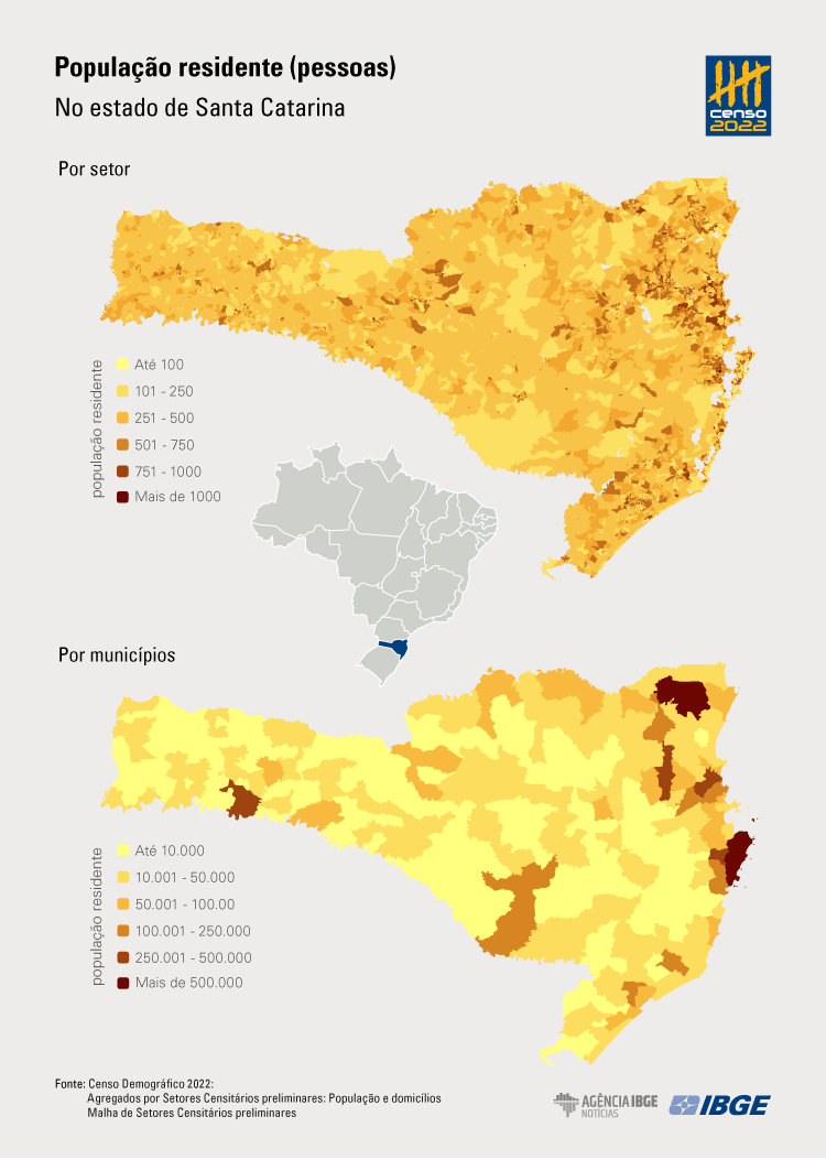
In Florianópolis/SC, some highlights are the districts of Ratones, with the smallest population (5,823 people), smallest number of housing units (2,511 housing units) and highest average of of residents in occupied housing units (2.69 people); Lagoa da Conceição, with the lowest average of residents in occupied housing units (2.19 people); and Florianópolis, with the biggest population (276,224 people) and the biggest number of housing units (134,210).
The district with the highest average og residents per occupied housing unit was Toricueije (6.6 residents), in Barra do Garças/MT.
Substricts of Ceilândia, in the Federal District, and Jacarepaguá, in Rio de Janeiro, are the most populated ones in their respective areas
In the Federal District, the subdistrict of Ceilândia is the most populated one, with 287,023 residents, followed by Samambaia, with 218,840. The subdistrict Parkway has the highest average of residents, with 3.34 people per housing unit, followed by Sol Nascente/Pôr do Sol, with 3.23.
In the city of Rio de Janeiro, the subdistrict of Jacarepaguá has the biggest population (653,492), followed by Campo Grande (600,464). The subdistrict with the smallest population is Ilha de Paquetá, with 3,486. Santa Cruz had the highest average of residents per subdistrict (2.78), whereas the lowest was found in the Downtown region (1.81).
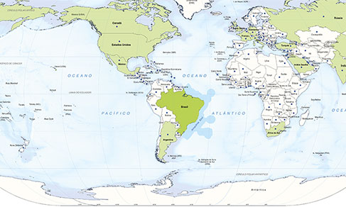
In 2022, more than half of the Brazilians lived up to 150 km far from the coast
OThe aggregated results by preliminary enumeration areas of the 2022 Census show that 111,277,361 people, which is equivalent to 54.8% of the population in Brazil, lived in enumeration areas located up to 150 km far from the coast. In Santa Catarina, this percentage reaches 75.4%, which corresponds to 5,734,702 residents living close to the sea.
It is also possible to observe the part of the Brazilian population that lived in the coastal area. A total of 9,416,714 people lived in enumeration areas located up to 150 km far from the frontier of Brazil with other countries. That is equivalent to 4.6% of the population in Brazil. In Santa Catarina, 11.4% of the population (866,171 people) lived close to the frontier with Argentina.
This assessmnent considered only the enumeration areas thoroughly encompassed by the range of 150 km from the frontier and the coast.
Almost half a million people lived in the surroundings of Avenida Brasil
Avenida Brasil, the main expressway in Rio de Janeiro, is more than 58 kilometers of extension. long. By analyzing data of the 2022 Census, the user finds out, for example, that 486,195 people lived in the 999 enumeration areas that were thoroughly or partially located within a maximum distance of 500 meters from the expressway. A total of 219,553 housing units, being 219,489 private and 64 collective, are in sectors located up to 500 meters far from Avenida Brasil, in its surroundings.
More about the survey
The Population Census is the main source of information about living conditions of the population in all the municipalities in the country and in its internal subdivisions. The population 2022 Population Census: Aggregated Results by Preliminary Enumeration Areas: makes available files for download with information, by Enumeration Areas, about the total number of persons and housing units surveyed all over the national territory. The 2022 Population Census: Mesh of preliminary Enumeration Areas presents digital vector files of the Enumaration Areas that represent the Brazilian territory in the IBGE’s censuses and surveys. Unprecedentedly, the aggregated results presented have been integrated into vector files of the Preliminary Mesh of Enumeration Areas, in a way as to facilitate geospatial analyses and statistics of census results.